The Amazon is often called the "lungs of the Earth" because it plays a critical role as a major carbon sink, helping to slow the pace of global warming. Without its carbon absorption capacity, global temperatures would rise more rapidly, leading to devastating consequences for the planet.
In addition to its role in carbon sequestration, the Amazon is home to over 3 million species of plants and animals, more than one million indigenous people, and countless local communities who live in close harmony with the rainforest.
However, deforestation has surged in the past two years, fueled by policies from the Brazilian president, who has encouraged industrial agriculture and mining in the world’s largest rainforest. Relentless deforestation, combined with massive wildfires to clear land for cattle grazing and soybean cultivation—key industries in Brazil—has had a catastrophic impact on the Amazon ecosystem. Experts warn that at the current rate of destruction, with an area the size of a football field being burned and cleared every 45 seconds, we are rapidly approaching a tipping point. If this continues, the point of no return will be reached within a few years.
This point of no return has already been reached in the Brazilian state of Mato Grosso, south of the Amazon, where the Cerrado—one of the world’s most important tropical savanna ecosystems—has been systematically destroyed for cattle ranching, new settlements, roads, and monoculture plantations. Today, Mato Grosso is the heart of Brazil’s industrial agriculture, with most of its forests and wildlife gone. This has led to record-breaking temperatures exceeding 40 degrees Celsius and the beginning of desertification, leaving only a few protected areas as isolated refuges in a growing sea of monoculture.
The natural habitats of indigenous peoples and local communities are under immense pressure as deforestation spreads deeper into the heart of the Amazon. The "green" frontier is expanding at an alarming rate, threatening their ways of life, livelihoods, and survival. If this destruction continues, the Earth itself will be the next to suffer.
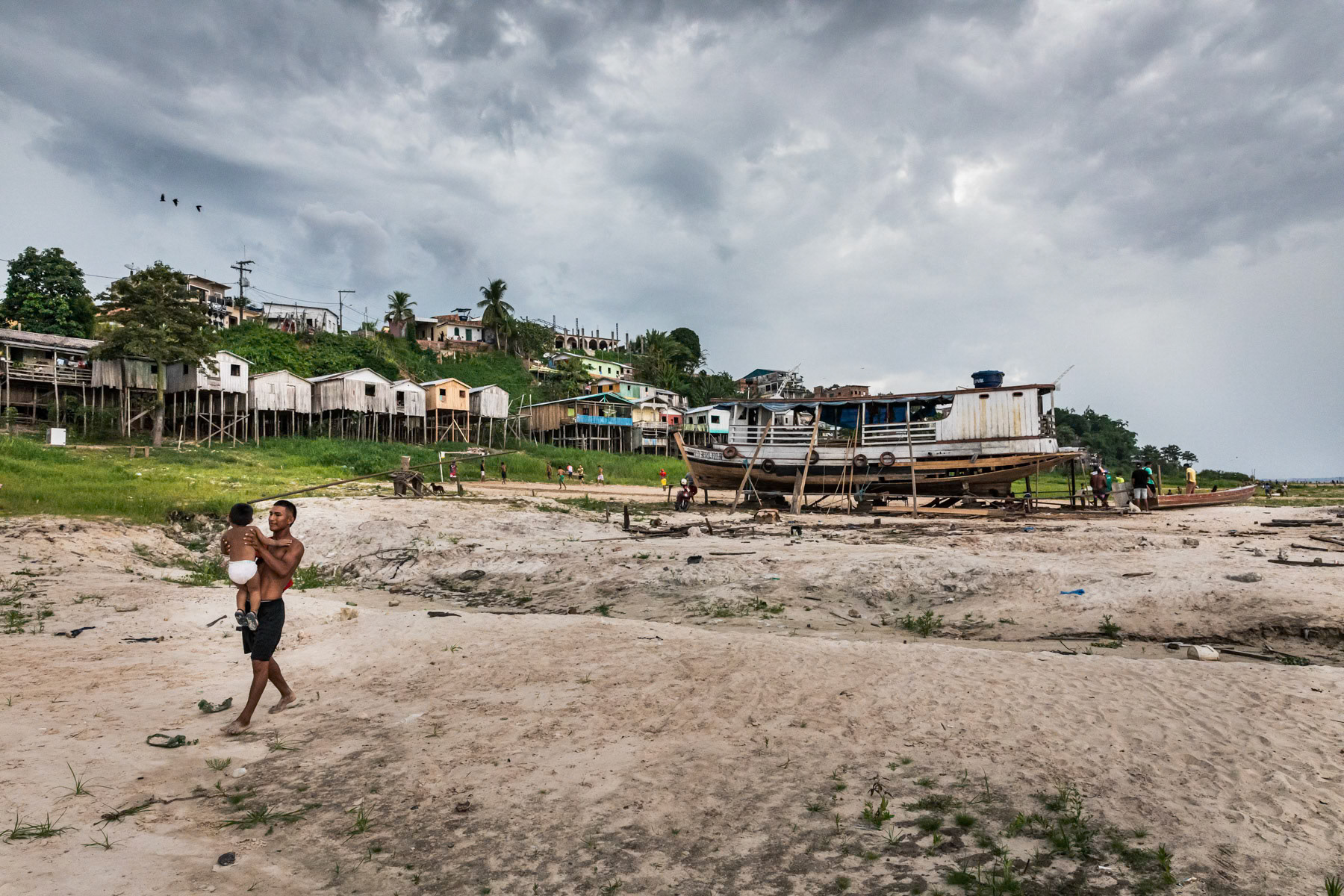
The Amazon is called the lungs of the earth because it plays a vital role as an essential carbon storage that slows the pace of global warming. Without the Amazon's carbon absorbation capacity, a rise in global temperature will accelerate and have devastating effects on the earth. Beside its carbon absorbing role, the Amazon is home to more than 3 million animal and plant species, more than one million indigenous people and many more millions of local communities that try to live in full harmony with the Amazonian rainforest. The levels of deforestation have increased dramatically during the past 2 years under the impulse of the Brazilian president who has encouraged industrial agriculture and mining activities in the world's largest rainforest. Relentless deforestation paired with massive wild fires to create cleared fields for cattle grazing and soya cultivation, big earners for Brazil, have a fatal impact on the Amazonian ecosystem. Experts estimate that at this pace of more than one football pitch being burnt and cleared every 45 seconds, the point of no-return will be reached in a couple of years. This point of no-return has been reached a long time ago in the Brazilian State of Mato Grosso, south of the Amazon, where the Sehado, a tropical savanna ecosystem, has been gradually and systematically destroyed to make place for cattle ranching, new towns and settlements, roads and mono-culture plantations. Mato Grosso is nowadays the heartland of Brazilians' industrial agriculture with the majority of its forests and fauna gone, leading to yearly record breaking temperatures well beyond 40 degrees and a desertification process starting to appear except in few protected areas remaining like islets in the middle of a mono-culture desert. The natural habitat of indigenous people and local communities is under tremendous pressure pushing deforestation deeper and deeper towards the heart of the Amazon, the "green" frontline is expanding at an ever growing pace; threatening their lifestyle, livelihood, subsistance and eventually survival. The earth will be next in line. The river bank along the Tefé river and its lake. Enormous variations in water level occur between the wet and dry season, hence a combination of floating habitations and houses on pilotis. Tefé, Amazonas state, Brazil, October 2020
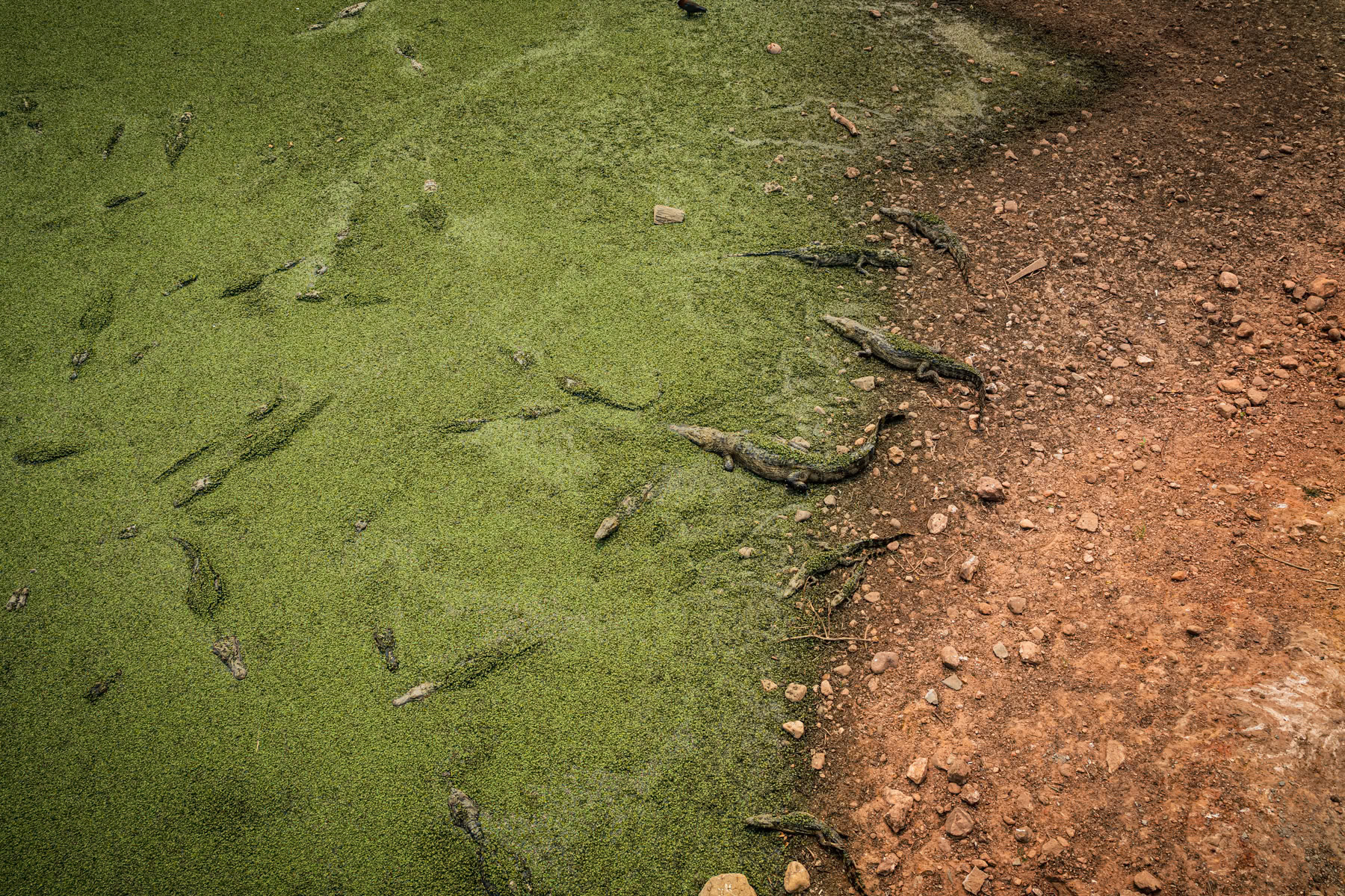
Yacare caiman surviving in little water left in the Pantanal natural region, the world's largest tropical wetlands. The Pantanal is an essential sanctuary for birds, and aquatic life and a habitat for caiman, deer and the endangered Pantanal jaguar. Pantanal natural reserve, Pocone, Mato Grosso, Brazil, October 2020
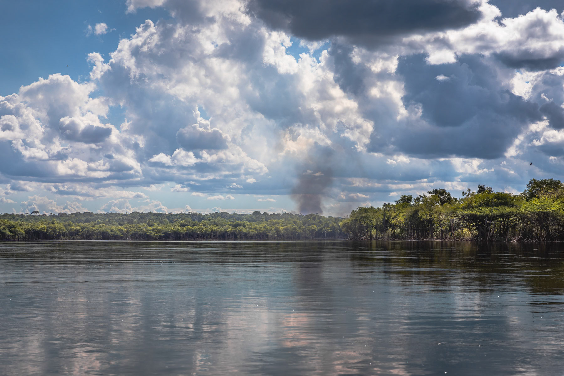
A fire to clear land for subsistance agriculture or for infrastructure development. The area attracts more and more groups that come fishing creating a higher demand for touristic infrastructure and ultimately access roads. Amazonian rainforest, Brazil, November 2020
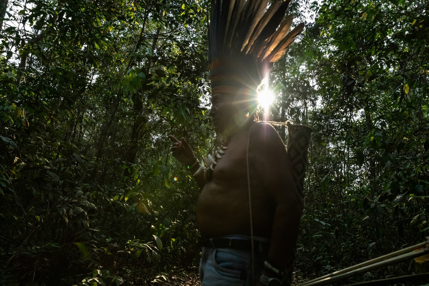
Village chief of the Paresi Indigenous People also called Halit in local language. 42 indigenous settlements are remaining in an area of 10000 km2 near Campo Novo Do Parecis, a city build in 1988 at the start of industrial agriculture expansion paired with massive Cerrado forest deforestation and displacement of indigenous people from their lands. Now a protected area, the original indigenous territory has been reduced by more than 75% since the eighties. Protected indigenous area, Campo Novo, Mato Grosso, Brazil, October 2020
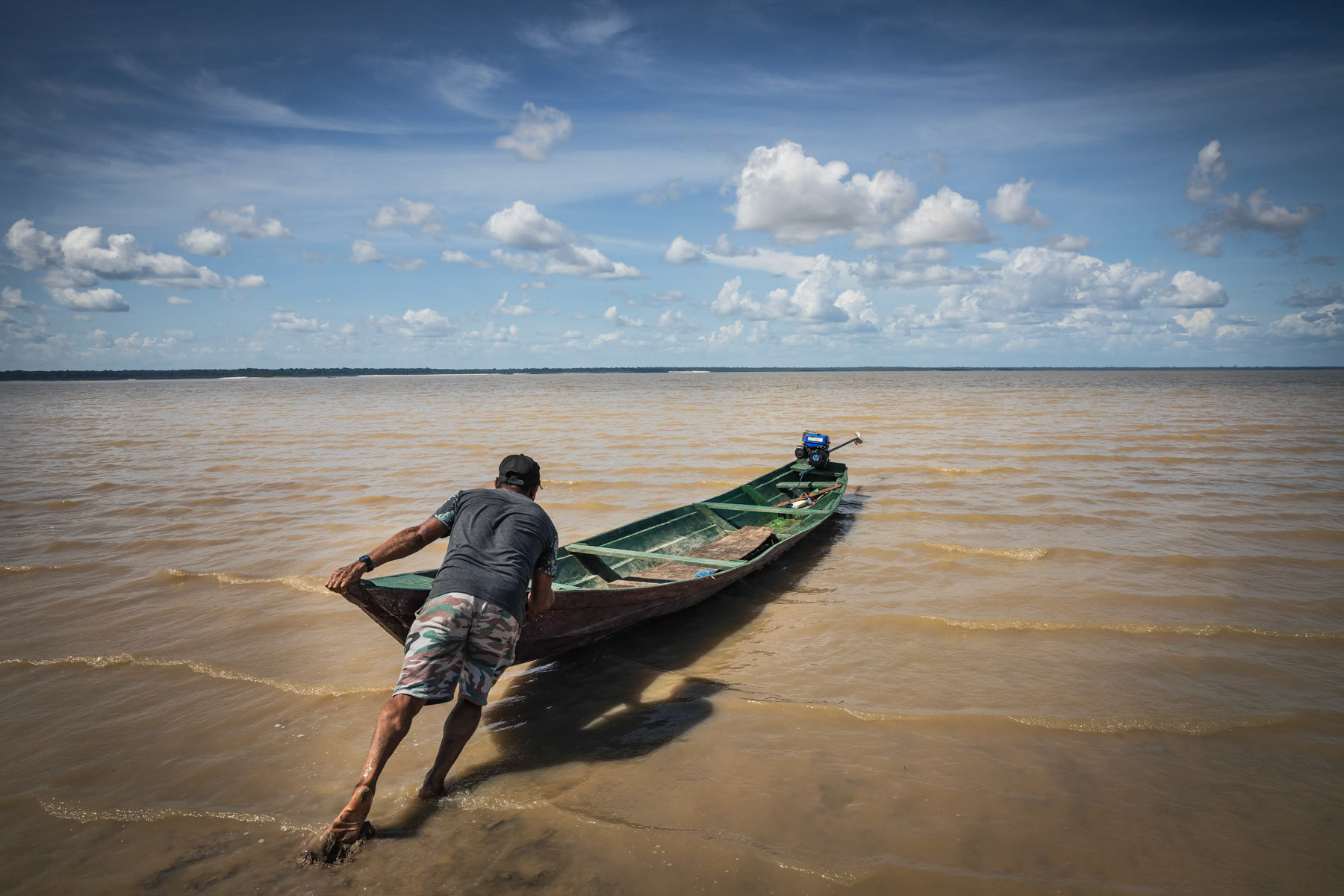
Small boat used to shuttle between villages around the Tefé lake. The Tefé river is a tributary of the Amazon. Before merging into the Amazon it forms a lake in the city of Tefé. Tefé and its surrounding vast area are only reachable by boat or airplane, no road network reach the area, keeping it protected from major agro industrial and deforestation projects. Tefé, Amazonas state, Brazil, October 2020
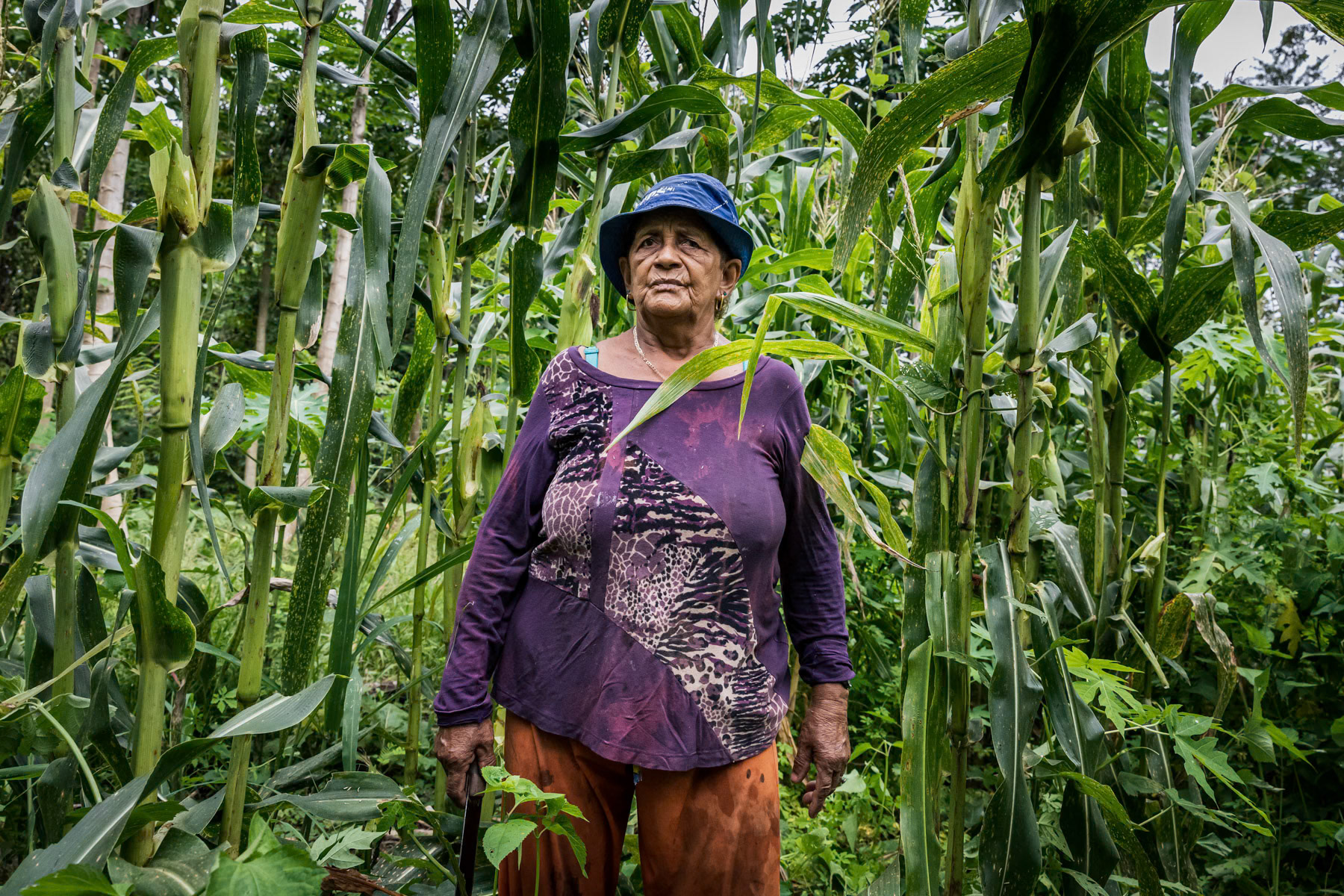
Small scale corn field along the Amazon river. Local communities would usually clear a 1000 m2 patch to build their low key habitat and cultivate corn or maniok and keep few chickens. Part of the yield will be sold upstream on the market in Tefé city. Porto São Francisco, Amazonas state, Brazil, October 2020
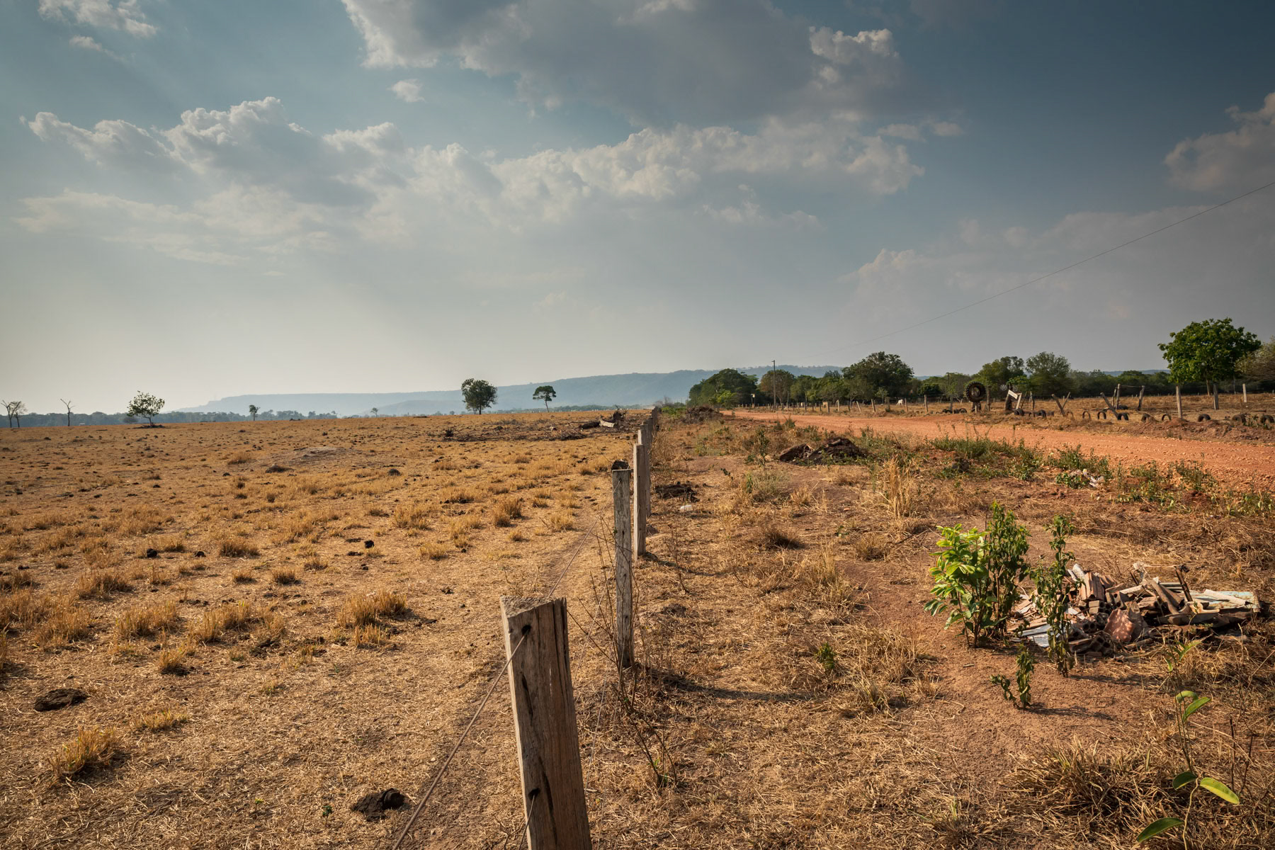
Deforested lands for cattle farming. Affected by accute water shortages only an average of one cow per hectare can be kept. Those small scale farms for local standards are in average 20 hectares. Barreirão near Nortelândia, Mato Grosso, Brazil, September 2020
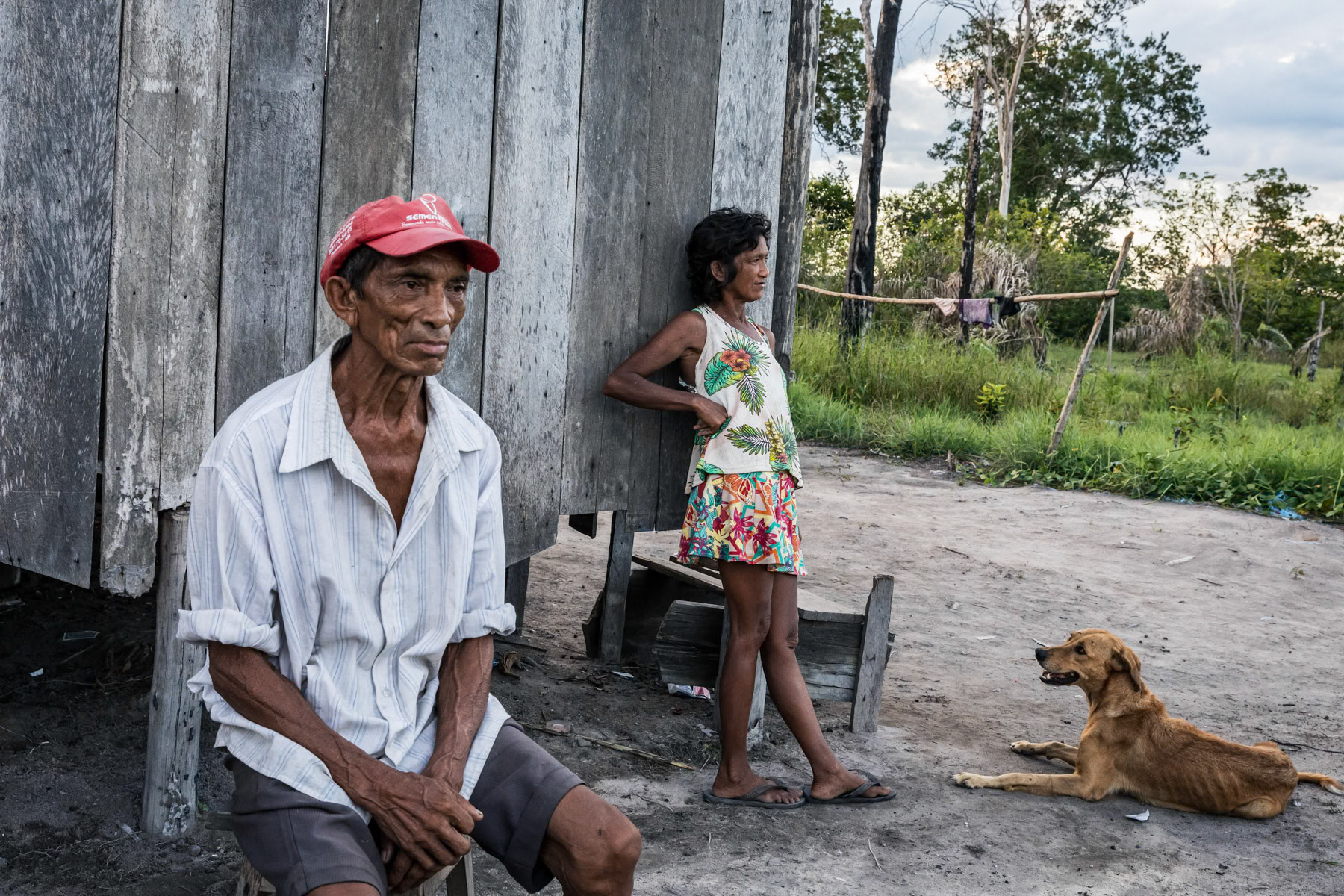
Indigenous people at their low key and small scale farm. Local communities would usually clear a 1000 m2 patch to build their small house and cultivate corn or maniok and keep few chickens. Part of the yield will be sold down stream in Lindoia, 2 hours away by boat. Amazonian rainforest, Amazonas state, Brazil, November 2020
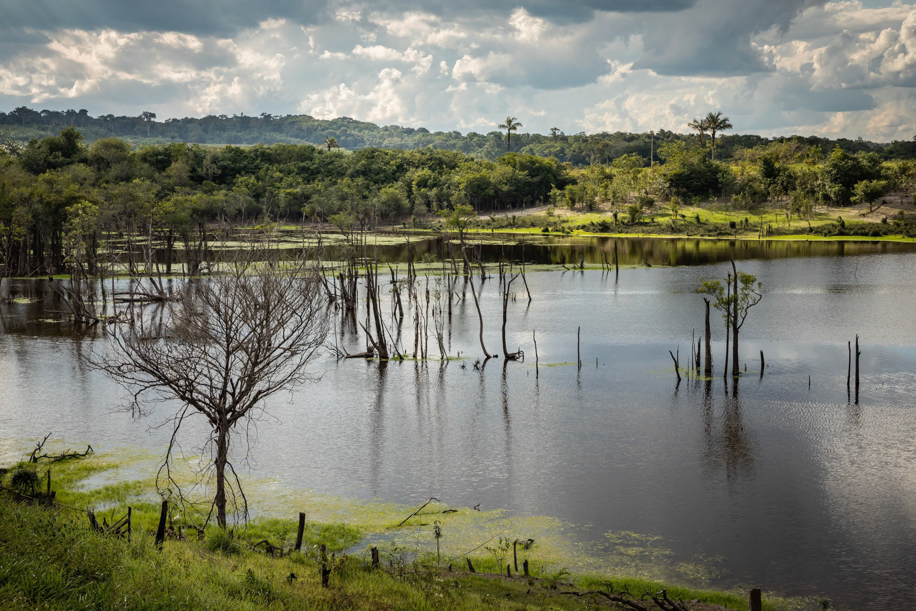
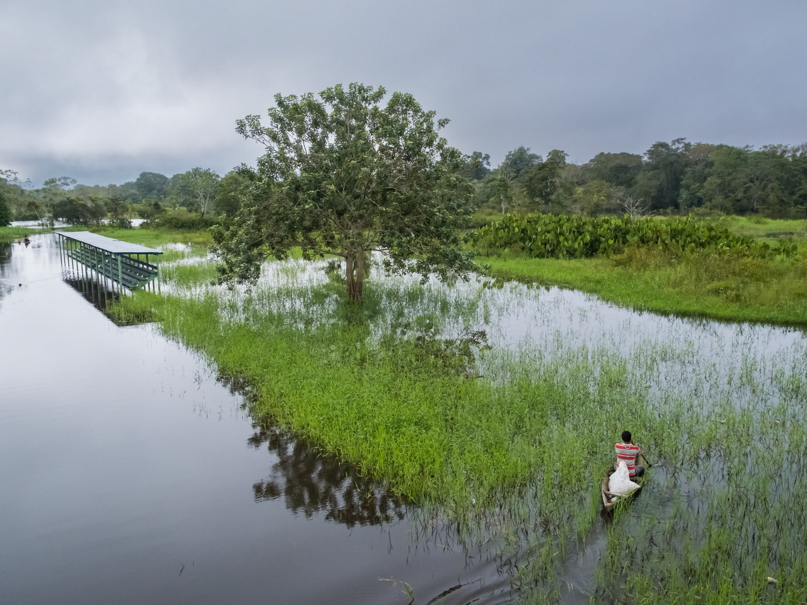
Amazonian rainforest along the Urubu river that is completely flooded from January until July. The combination of the rain season and snow melting in the Andes transforms the Amazonian rivers into lakes and floods the adjacent forests, hence these trees are submerged for nearly 6 months per year. Urubu river basin, Amazonia, Brazil, November 2020
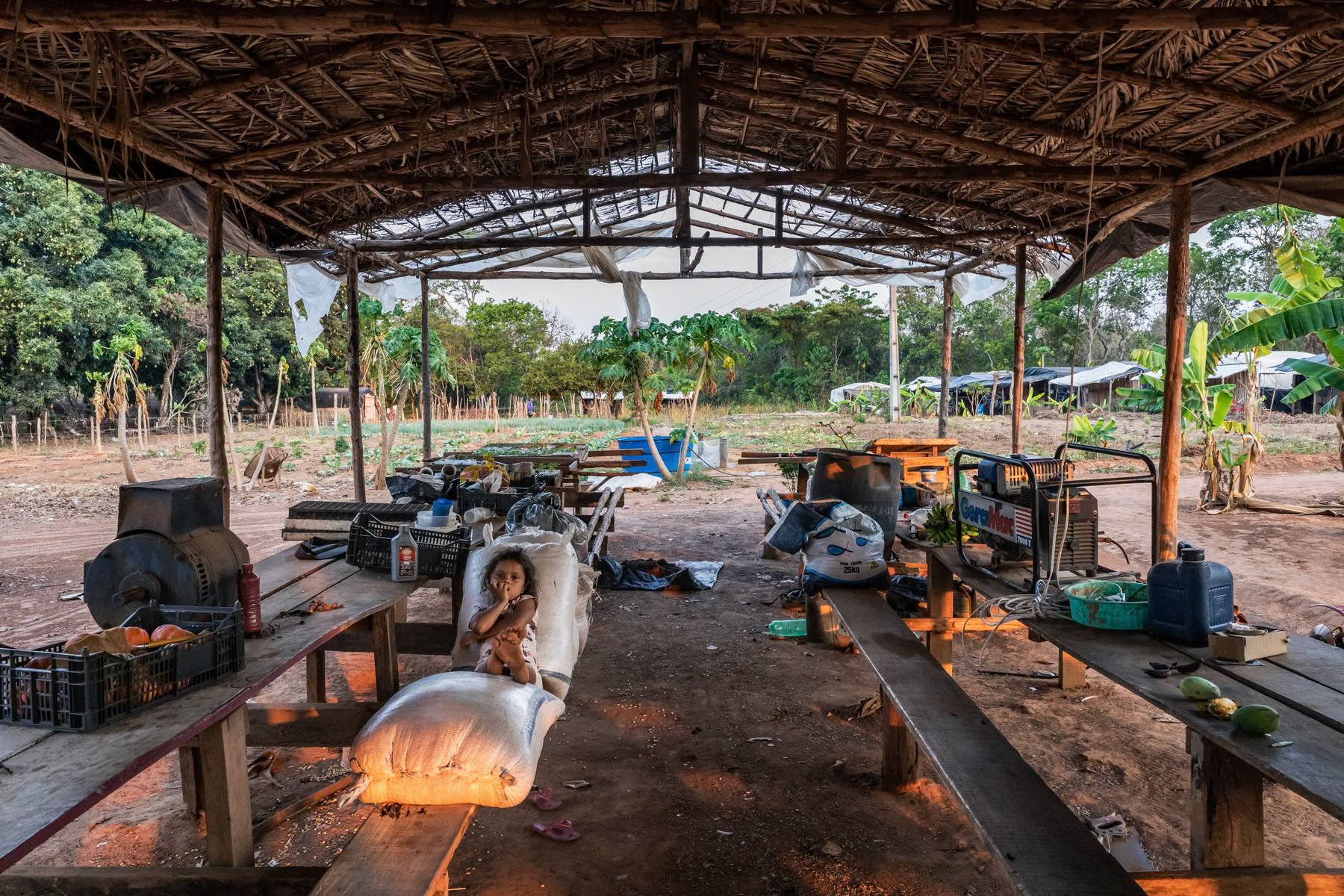
A small vegetable and fruit cooperative consiting a few families working and living together on site. Unfortunately they do not have clear land use rights and could be expelled at any time to make place for the larger agriibusiness lobby. Nortelândia, Mato Grosso, Brazil, September 2020
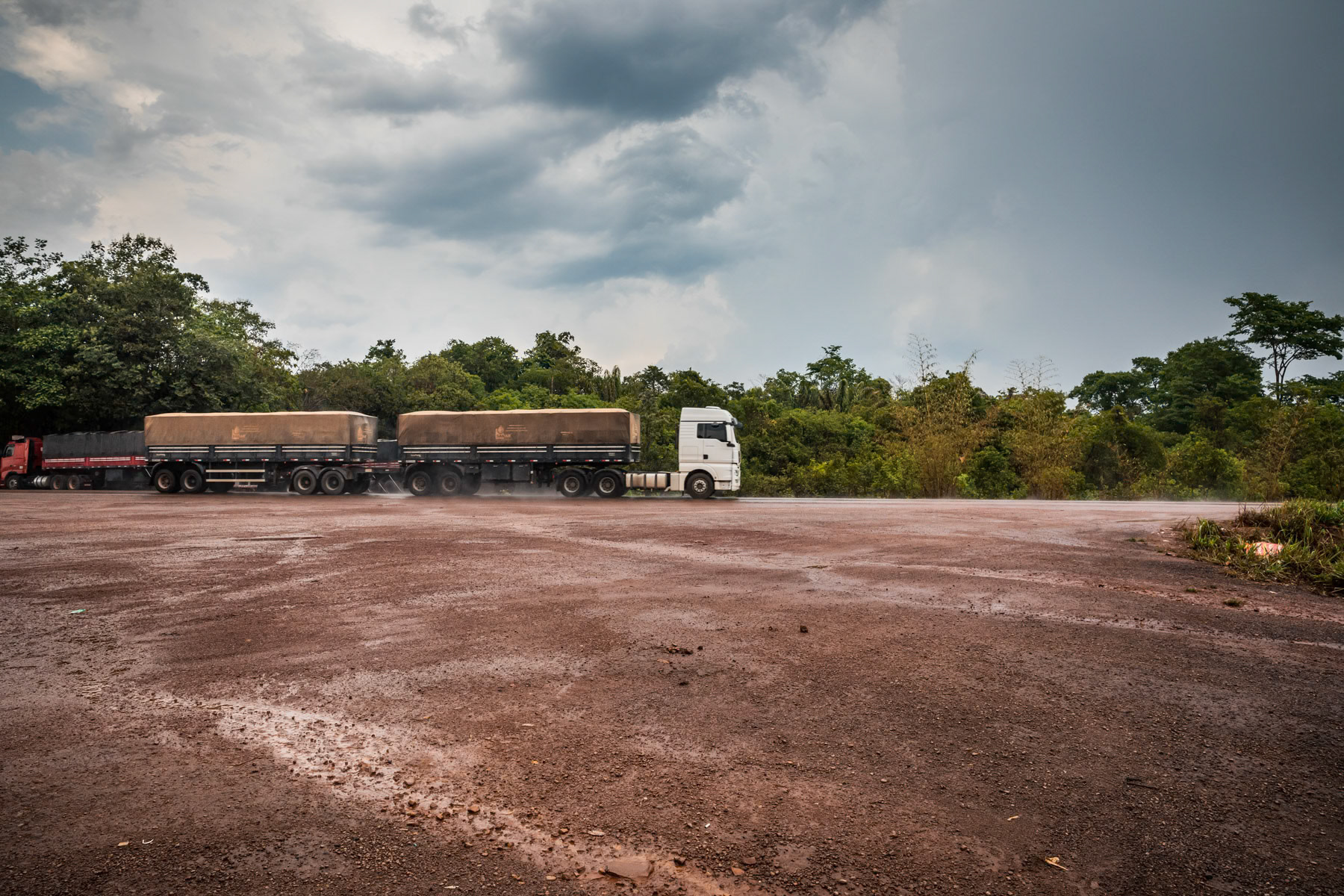
Trucks transporting soybeans to the port of Santarem along the main road BR163. BR163 is one of the 3 developped roads cutting through the Amazone linking it with Mato Groso and part of the deforestation arc or green frontlines. The State of Para is now victim of massive deforestation in order to expand monoculture and cattle farming beyong Mato Grosso well into the Amazon. Usually 50 km on both sides of a new route are fully cleared through the years and vegetation is replaced by industrial farming. Para State, Brazil, October 2020
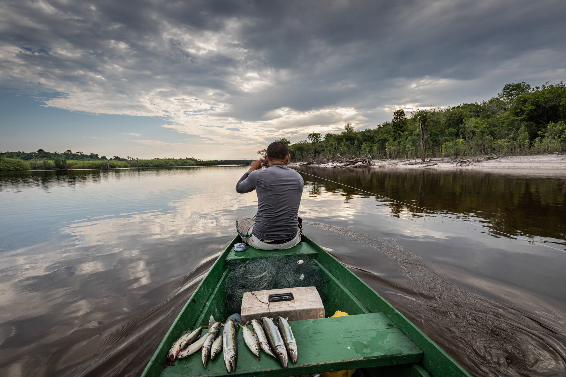
Fishing, Urubu river a tributary of the Amazon river. Amazonian rainforest, Amazonas state, Brazil, November 2020
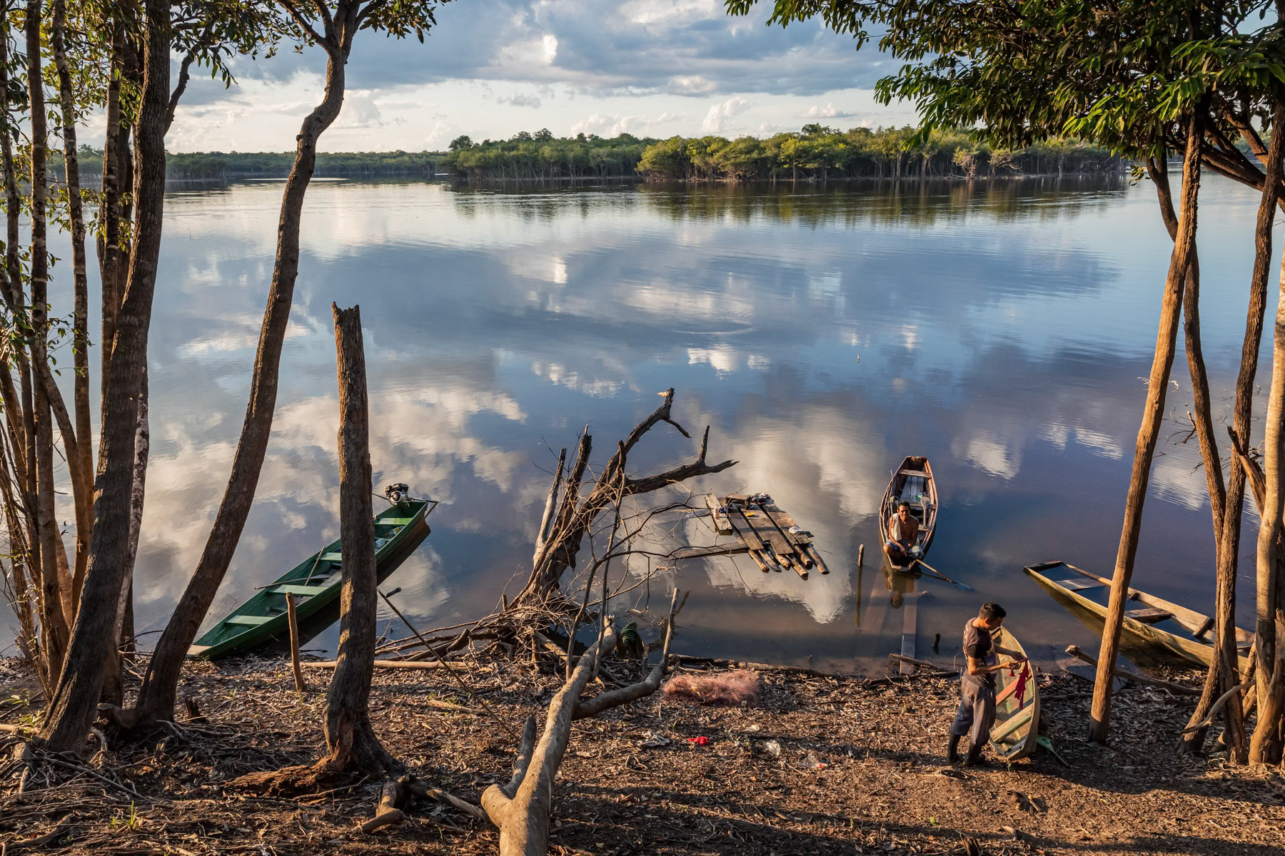
A villager repairing his canoe along the Urubu river in the Amazonian rainforest, Amazonia, Brazil, November 2020
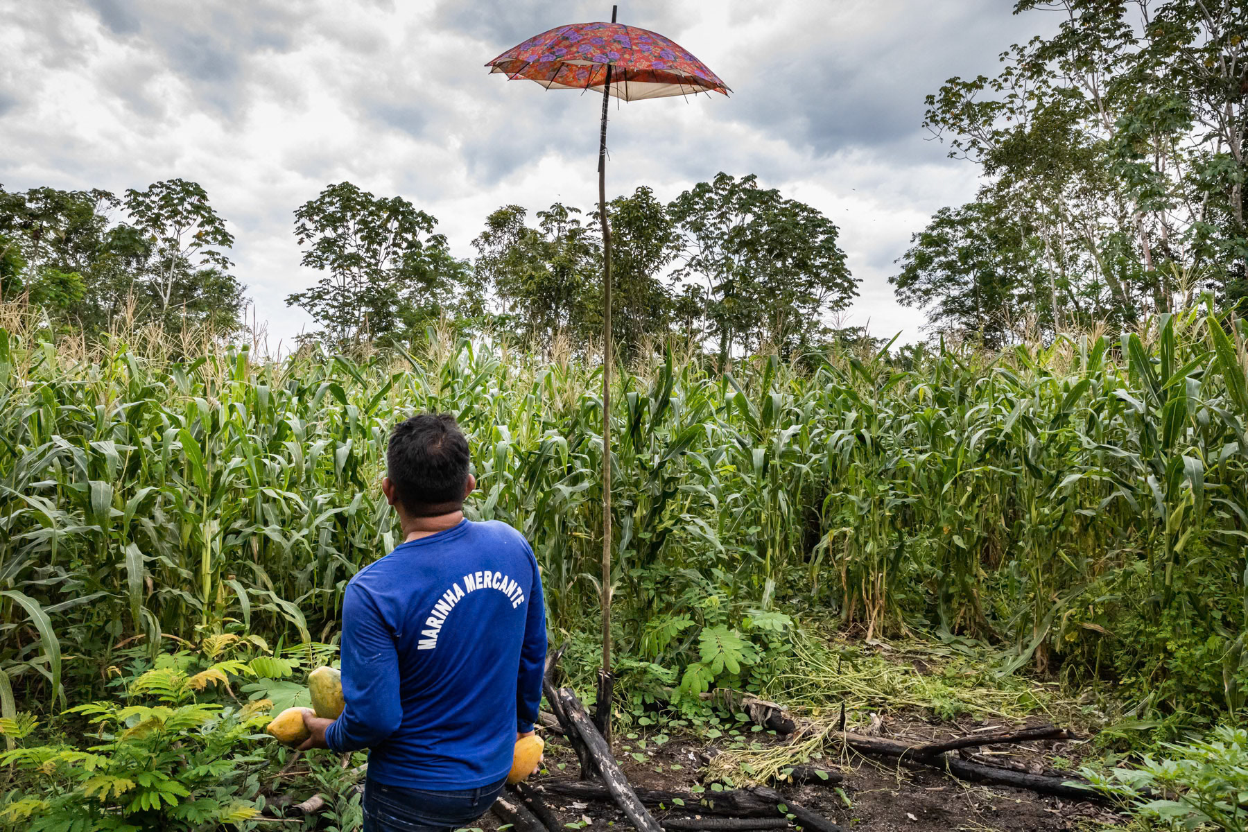
Small scale corn field along the Amazon river. Local communities would usually clear a 1000 m2 patch to build their low key habitat and cultivate corn or maniok and keep few chickens. Part of the yield will be sold upstream on the market in Tefé city. Porto São Francisco, Amazonas state, Brazil, October 2020
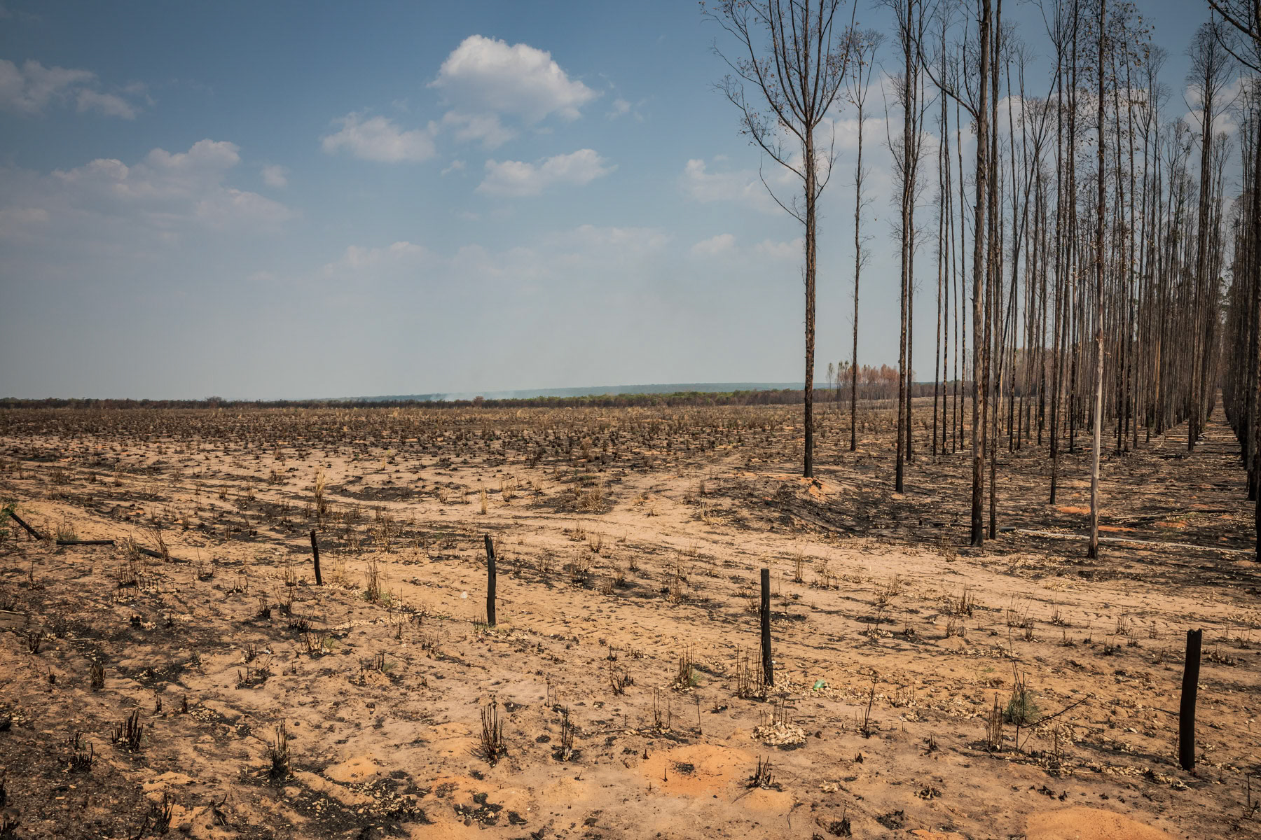
An eucalytus plantation affected by provoked bush fires while clearing land for further expansion of monoculture farming such as soybeans, cotton or cattle ranching. Road to Nova Mutun, Mato Grosso, Brazil, September 2020
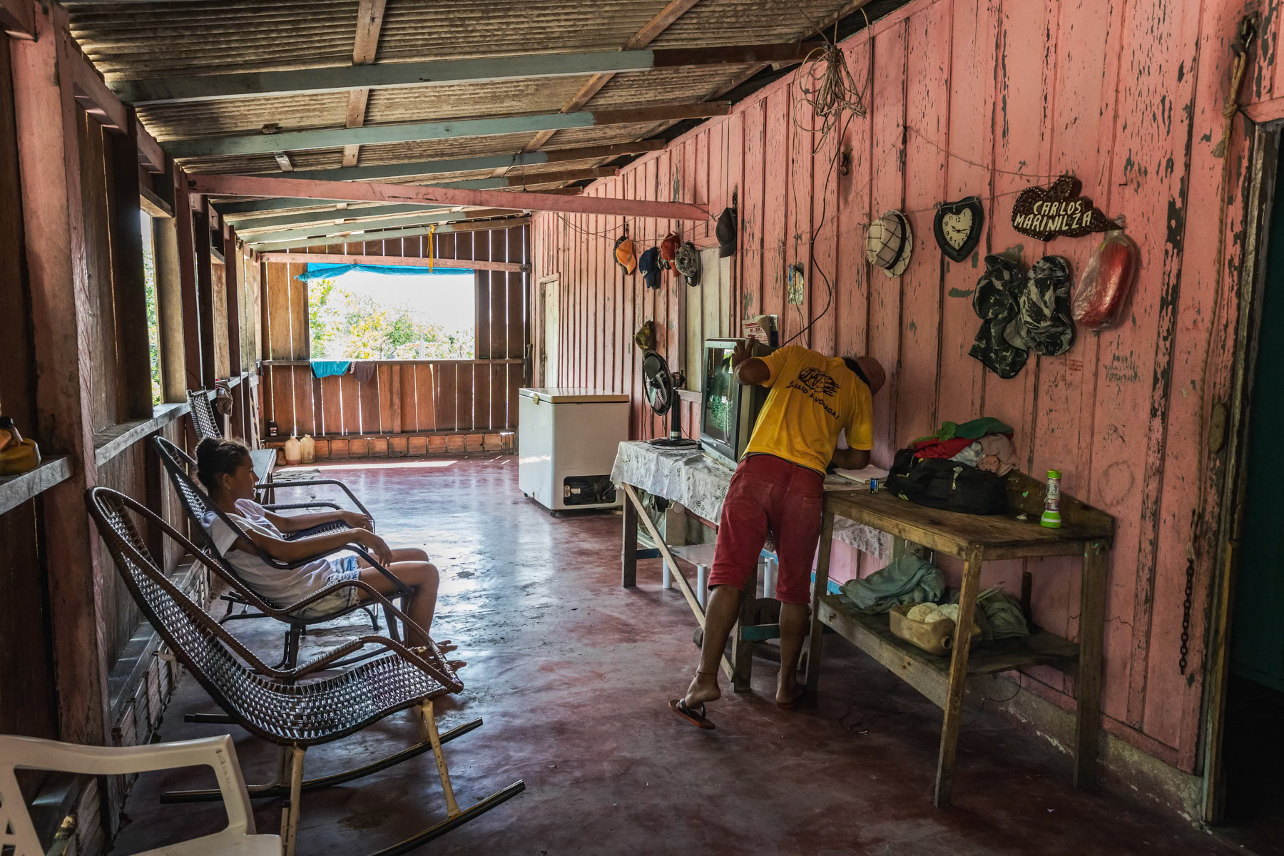
A typical Amazonian house in a remote area only reachable by boat and foot depending of the time of the year and the water level. Urubu river basin one hour from the samll town of Lindoia the last place reachable by road. Amazonas state, Brazil, October 2020
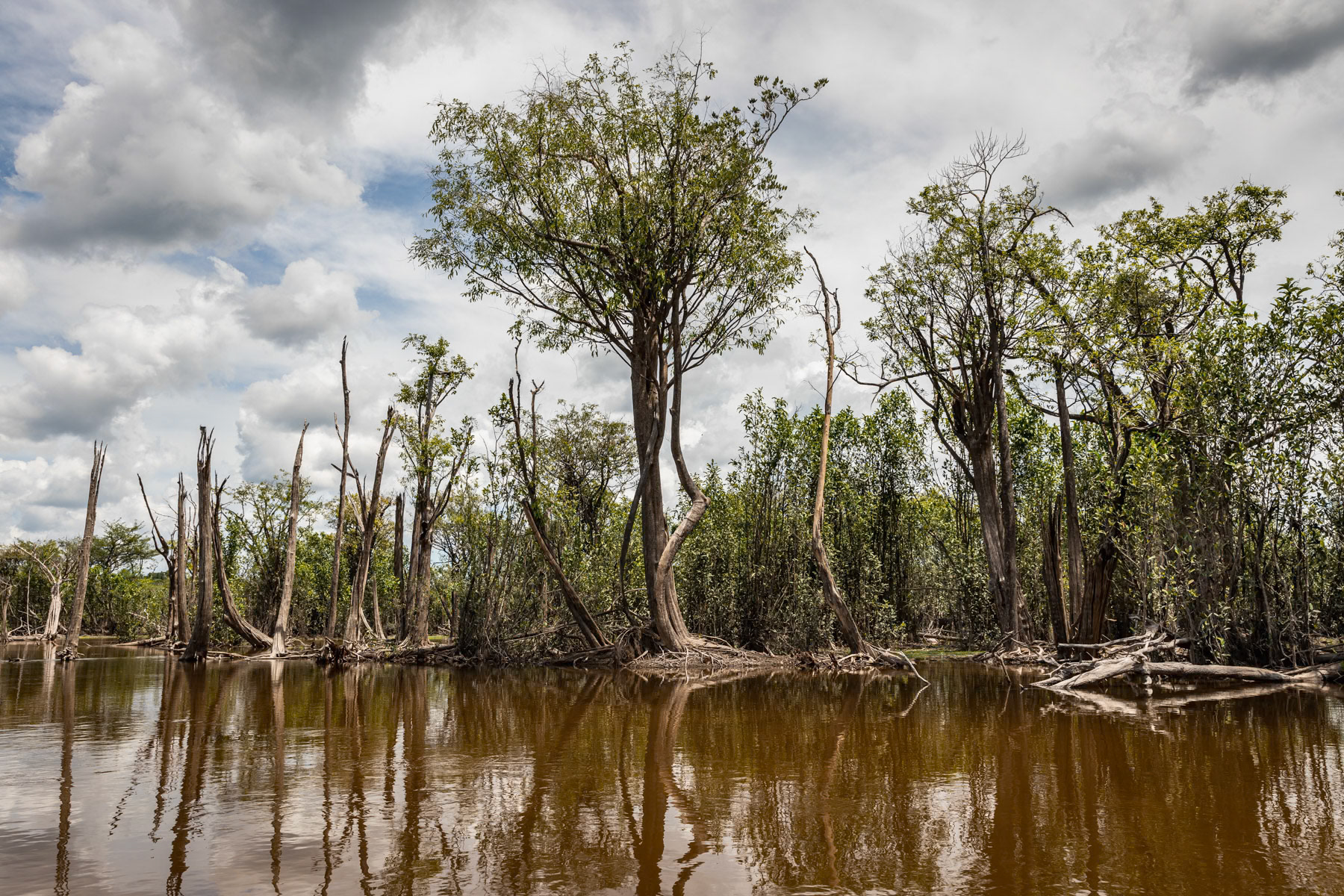
Amazonian rainforest along the Urubu river that is completely flooded from January until July. The combination of the rain season and snow melting in the Andes transforms the Amazonian rivers into lakes and floods the adjacent forests, hence these trees are submerged for nearly 6 months per year. Urubu river basin, Amazonia, Brazil, November 2020
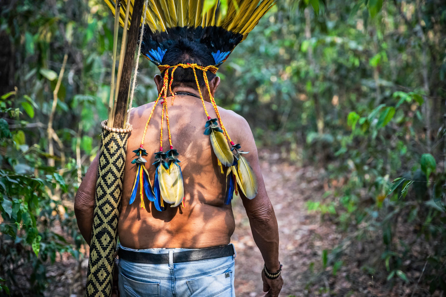
Village chief of the Paresi Indigenous People also called Halit in local language. 42 indigenous settlements are remaining in an area of 10000 km2 near Campo Novo Do Parecis, a city build in 1988 at the start of industrial agriculture expansion paired with massive Cerrado forest deforestation and displacement of indigenous people from their lands. Now a protected area, the original indigenous territory has been reduced by more than 75% since the eighties. Protected indigenous area, Campo Novo, Mato Grosso, Brazil, October 2020
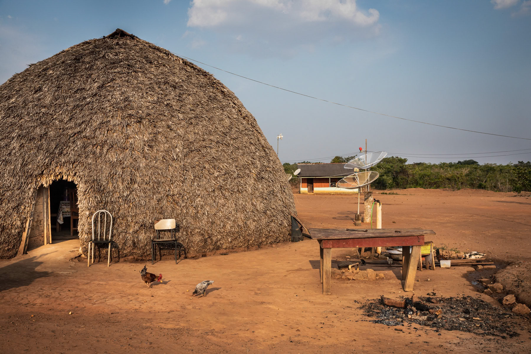
Traditional habitat where all generations of a family live under one roof. 42 indigenous settlements are remaining in a protected area of 10000 km2 near Campo Novo Do Parecis, a city build in 1988 at the start of industrial agriculture expansion paired with massive Cerrado forest deforestation and displacement of indigenous people from their lands. Now a protected area, the original indigenous territory has been reduced by more than 75% since the eighties. Protected indigenous area, Campo Novo, Mato Grosso, Brazil, October 2020
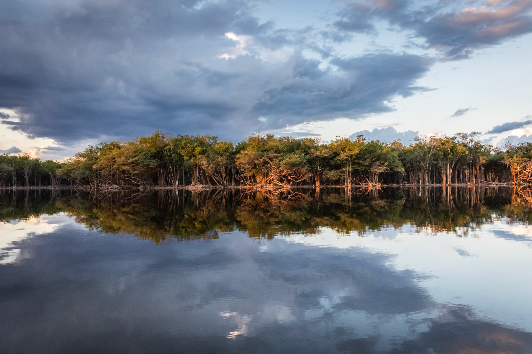
Amazonian rainforest along the Urubu river that is completely flooded from January until July. The combination of the rain season and snow melting in the Andes transforms the Amazonian rivers into lakes and floods the adjacent forests, hence these trees are submerged for nearly 6 months per year. Urubu river basin, Amazonia, Brazil, November 2020
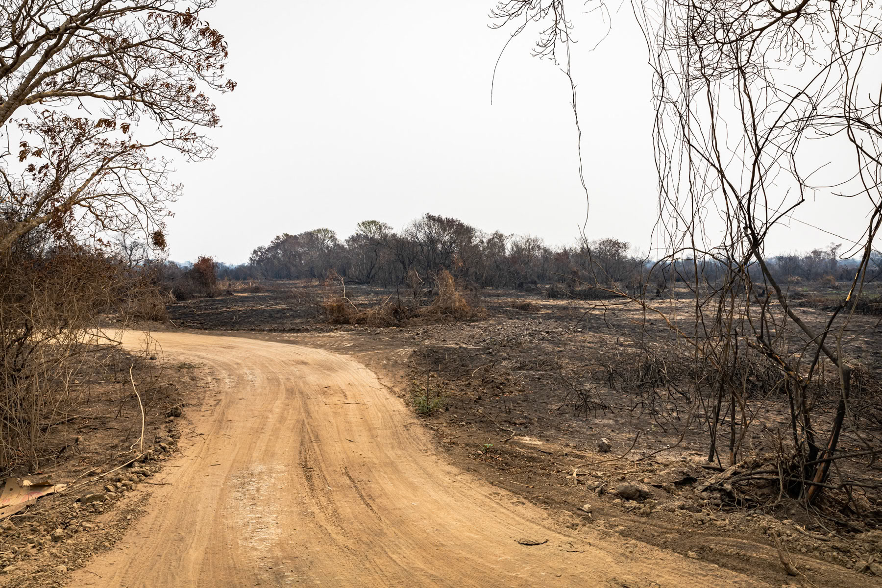
The Pantanal natural reserve is the world's largest tropical wetland and flooded grasslands. This essential ecosystem is under severe treat due to cattle ranching, over fishing, poaching and hunting, pollution from mining and agro-industry, tourism infrastructure and forest fires. In late 2020 more than 25% (more than 25,000 km2) of the wetland's fauna was destroyed by wild fires due to climate change and arson. Pantanal, Mato Grosso, Brazil, October 2020
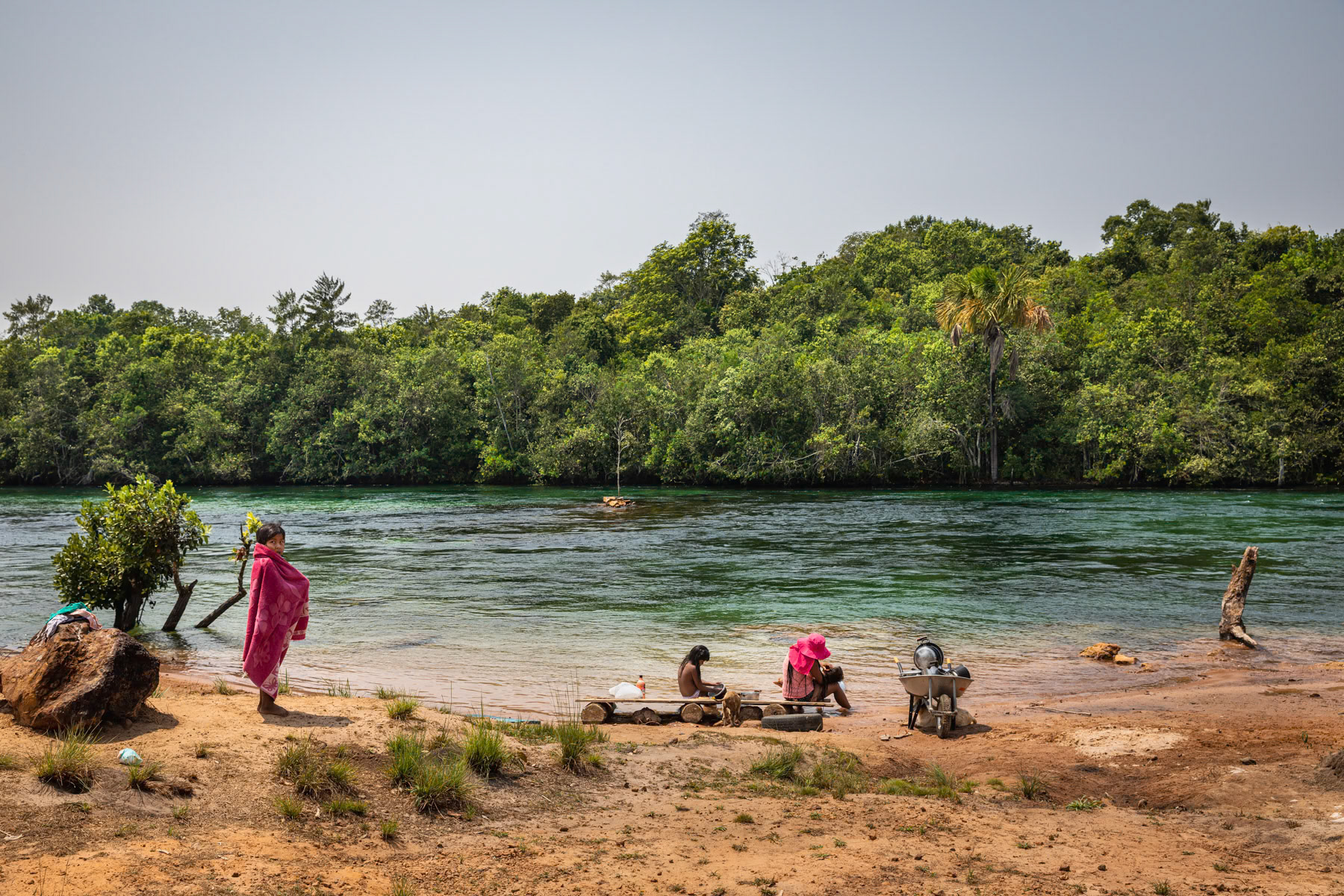
Paresi indigenous people in Mato Grosso along the river in a protected area where 42 settlements are spread withing 10000km2 of Cerrado forest, a small remaining oasis in the midst of industrial agriculture expansion. Campo Novo Do Parecis, Mato Grosso, Brazil, October 2020
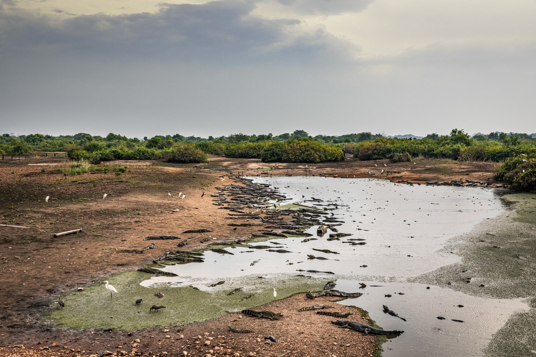
Yacare caiman surviving in little water left. The Pantanal natural reserve is the world's largest tropical wetland and flooded grasslands. This essential ecosystem is under severe treat due to cattle ranching, over fishing, poaching and hunting, pollution from mining and agro-industry, tourism infrastructure and forest fires. In late 2020 more than 25% (more than 25,000 km2) of the wetland's fauna was destroyed by wild fires due to climate change and arson. Pantanal, Mato Grosso, Brazil, October 2020
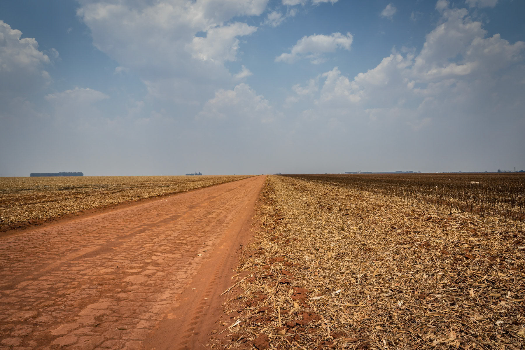
Access road through monoculture fields that replaced the Cerrado, a Savanna type biome that is the second largest ecosystem after the Amazon. These lands used to be inhabited by indigenous people that have now been driven into much smaller and vulnerable indigenous 'protected' areas. Campo Novo Do Parecis, Mato Grosso, Brazil, October 2020
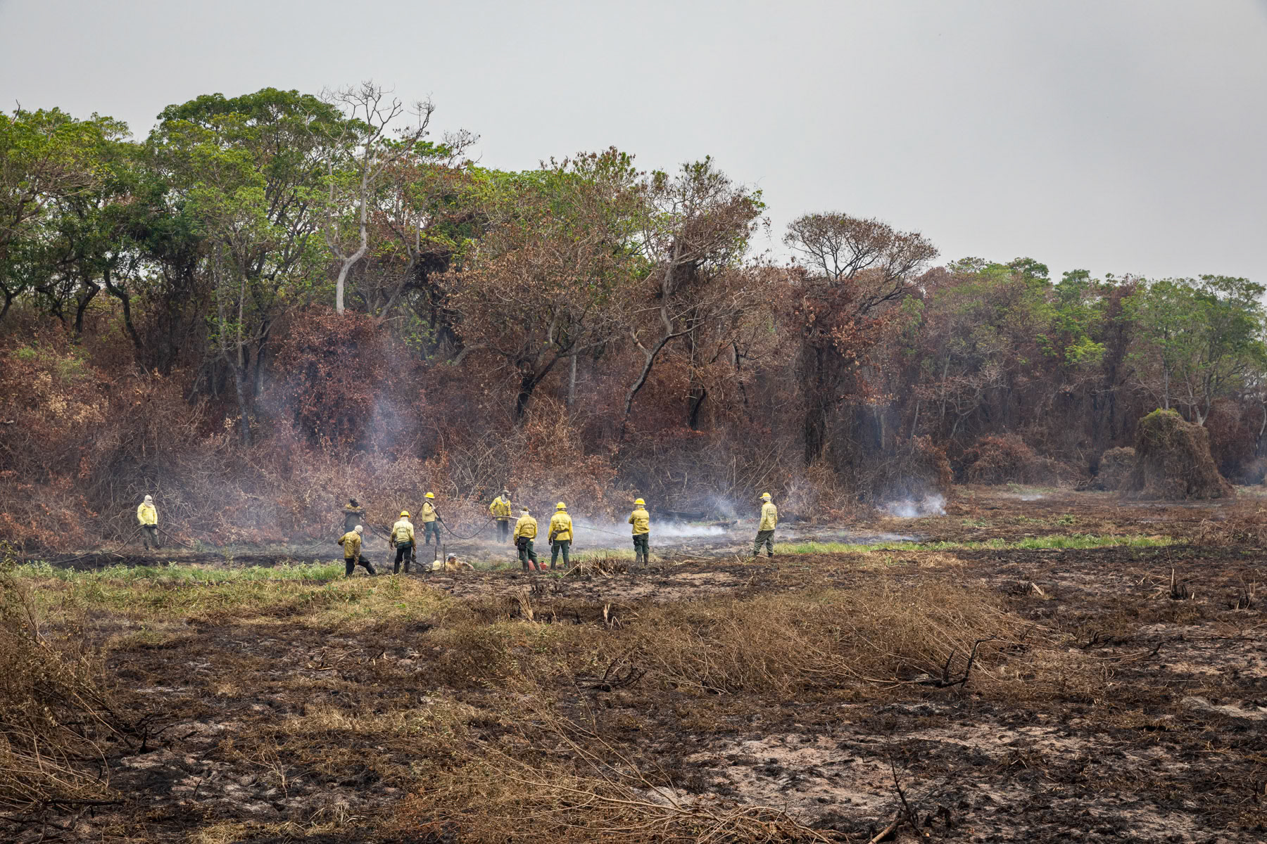
Fires fighters working relentlessly to control the forest fires. The Pantanal natural reserve is the world's largest tropical wetland and flooded grasslands. This essential ecosystem is under severe treat due to cattle ranching, over fishing, poaching and hunting, pollution from mining and agro-industry, tourism infrastructure and forest fires. In late 2020 more than 25% (more than 25,000 km2) of the wetland's fauna was destroyed by wild fires due to climate change and arson. Pantanal, Mato Grosso, Brazil, October 2020
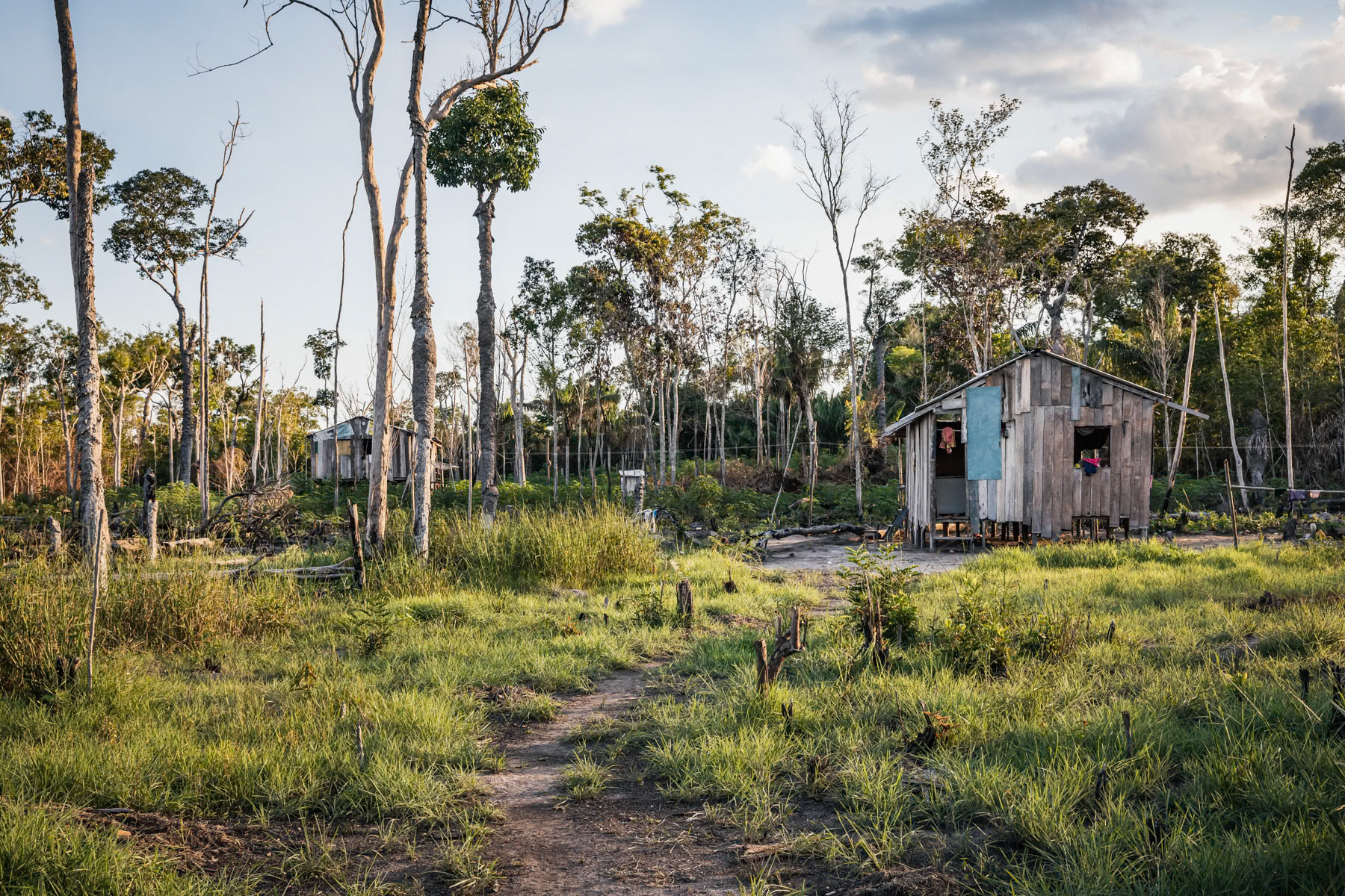
Small scale farm. Local communities would usually clear a 1000 m2 patch to build their small house and cultivate corn or maniok and keep few chickens. Part of the yield will be sold down stream in Lindoia, 2 hours away by boat. Amazonian rainforest, Amazonas state, Brazil, November 2020
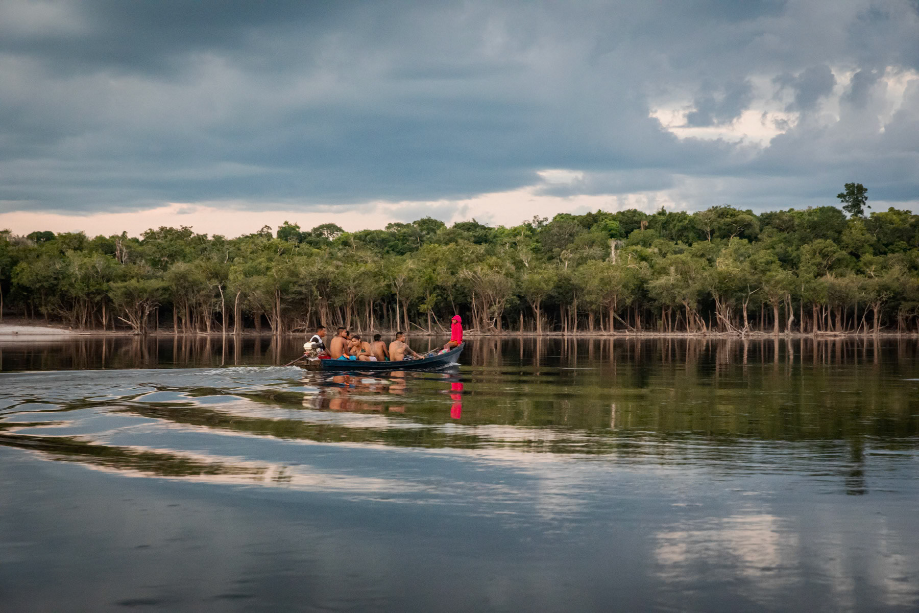
Villagers going to Lindoia, the first small town 2 hours away and closest for markets, basic healthcare and school. Children leave as early as 4am to reach school in time in the morning. Urubu river, Amazonia, Brazil, November 2020
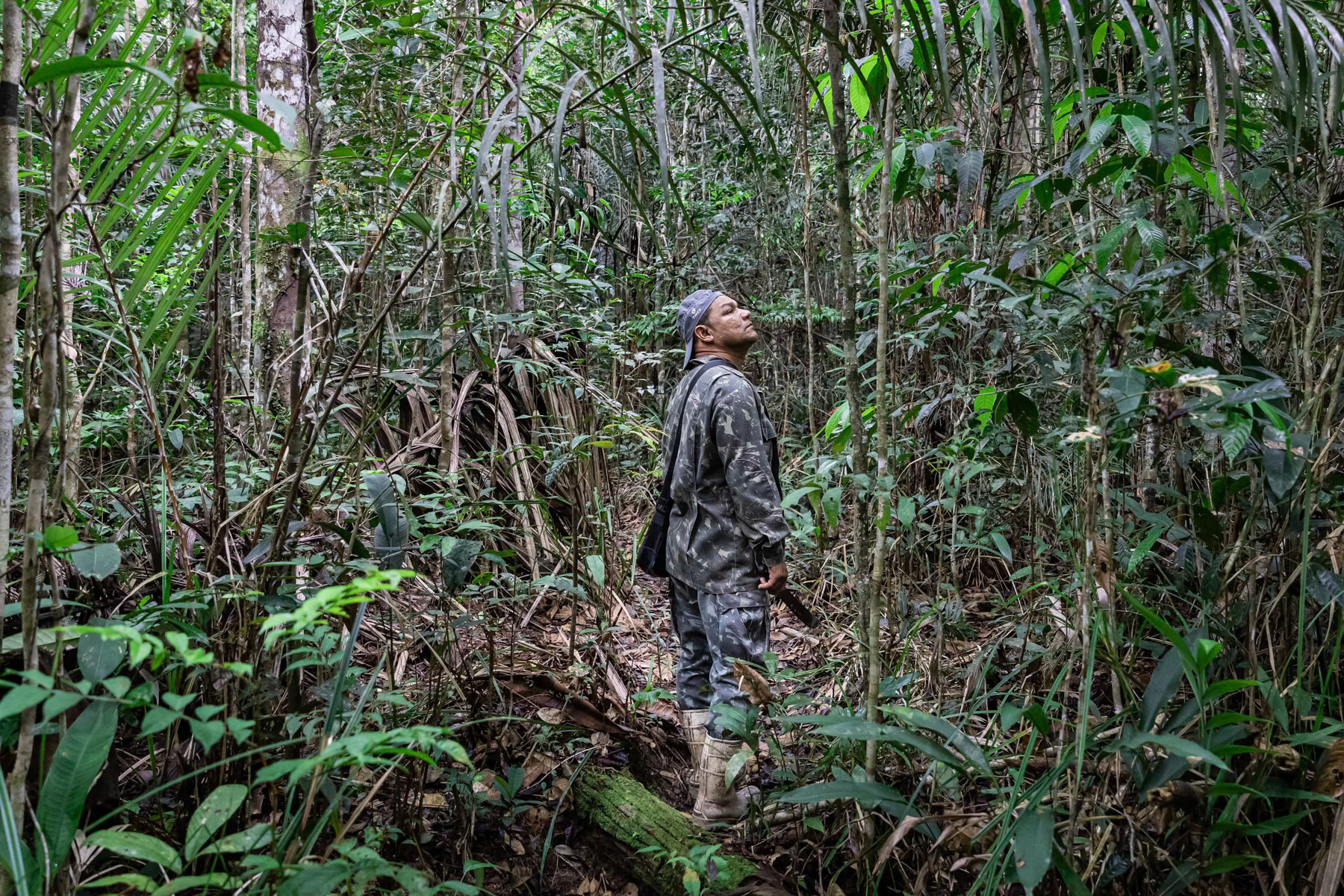
Leo was raised and lived his whole life in the rainforest. For the past decade he has been guiding people and raise awareness this unique valuable ecosystem. Due to the corona virus outbreak all activities have stopped as the communities of the Amazon have been dramatically affected by the virus. Amazonian rainforest, Brazil, November 2020
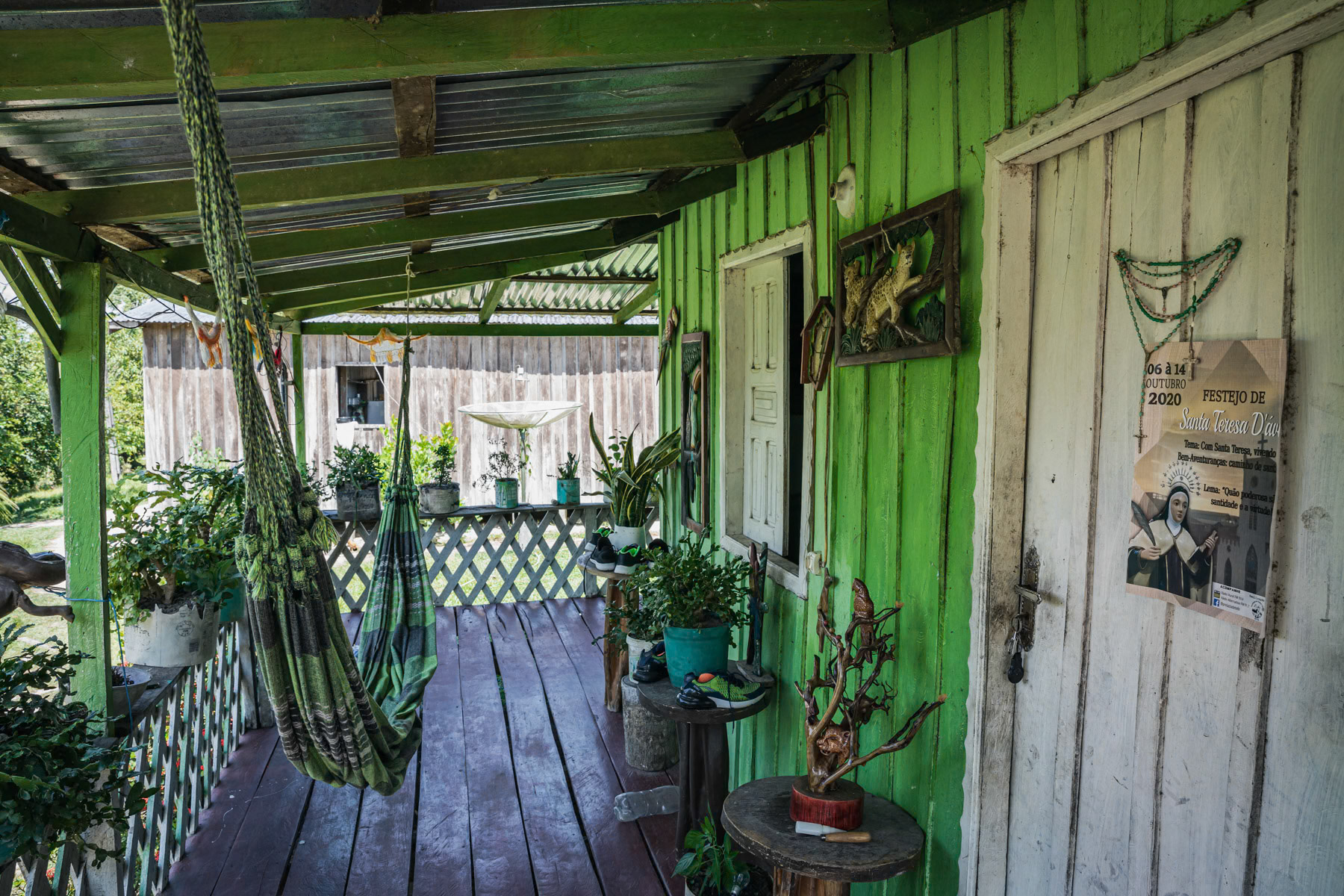
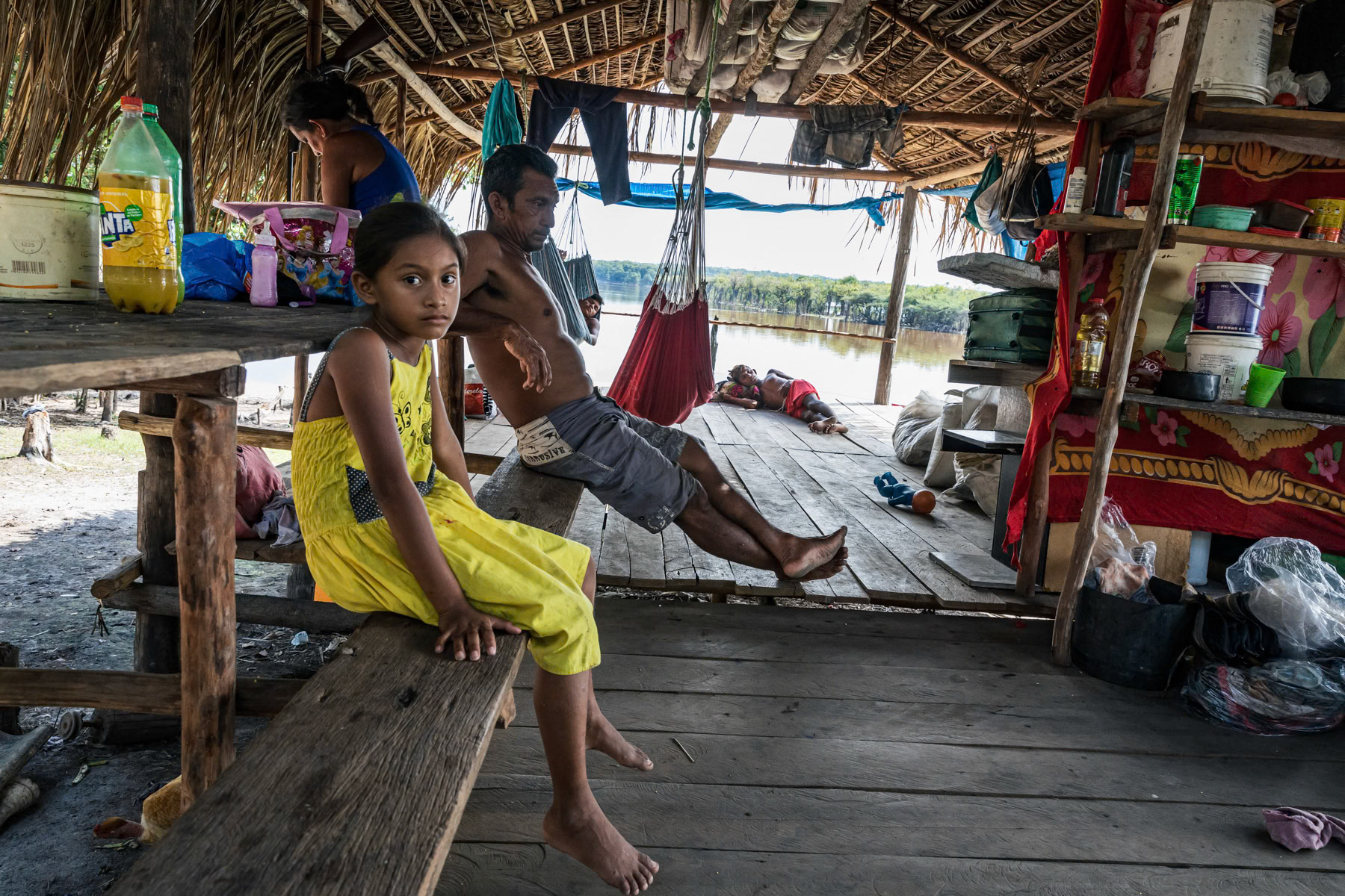
A typical house in an Amazonian village in usually remote areas only reachable by small boats and foot depending of the time of the year and the water level of the rivers. Ipapucu community 2 hours from Tefé the region's main city. Ipapucu, Amazonas state, Brazil, October 2020
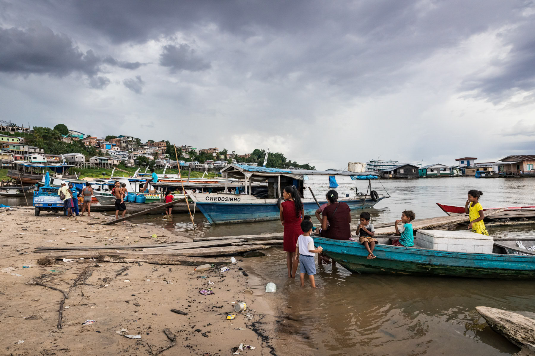
People from nearby villages returning home by boat with supplies bought in the city. The Tefé river is a tributary of the Amazon. Before merging into the Amazon it forms a lake in the city of Tefé. Tefé and its surrounding vast area are only reachable by boat or airplane, no road network reach the area keeping, it protected from major agro industrial and deforestation projects. Tefé, Amazonas state, Brazil, October 2020
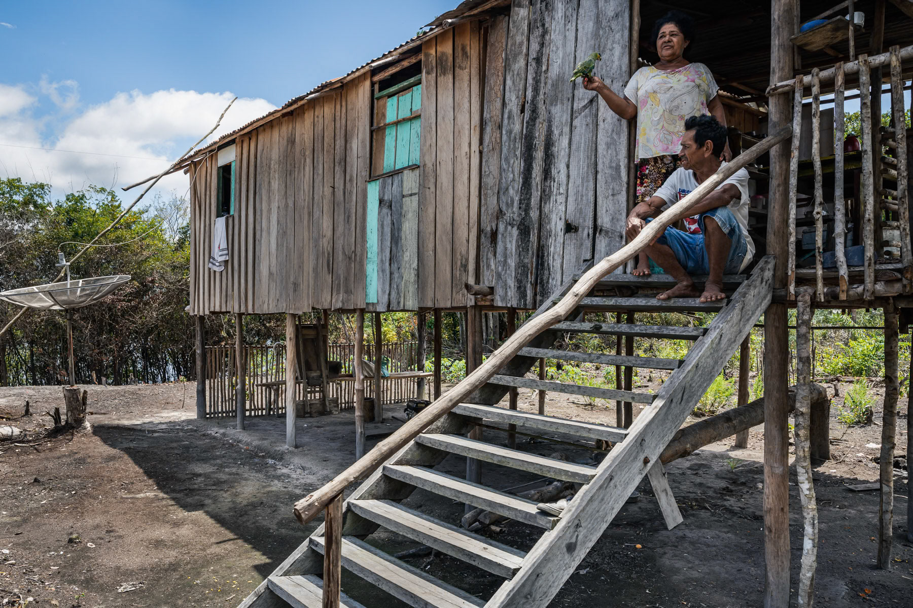
Indigenous people at their low key and small scale farm. Local communities would usually clear a 1000 m2 patch to build their small house and cultivate corn or maniok and keep few chickens. Part of the yield will be sold down stream in Lindoia, 2 hours away by boat. Amazonian rainforest, Amazonas state, Brazil, November 2020
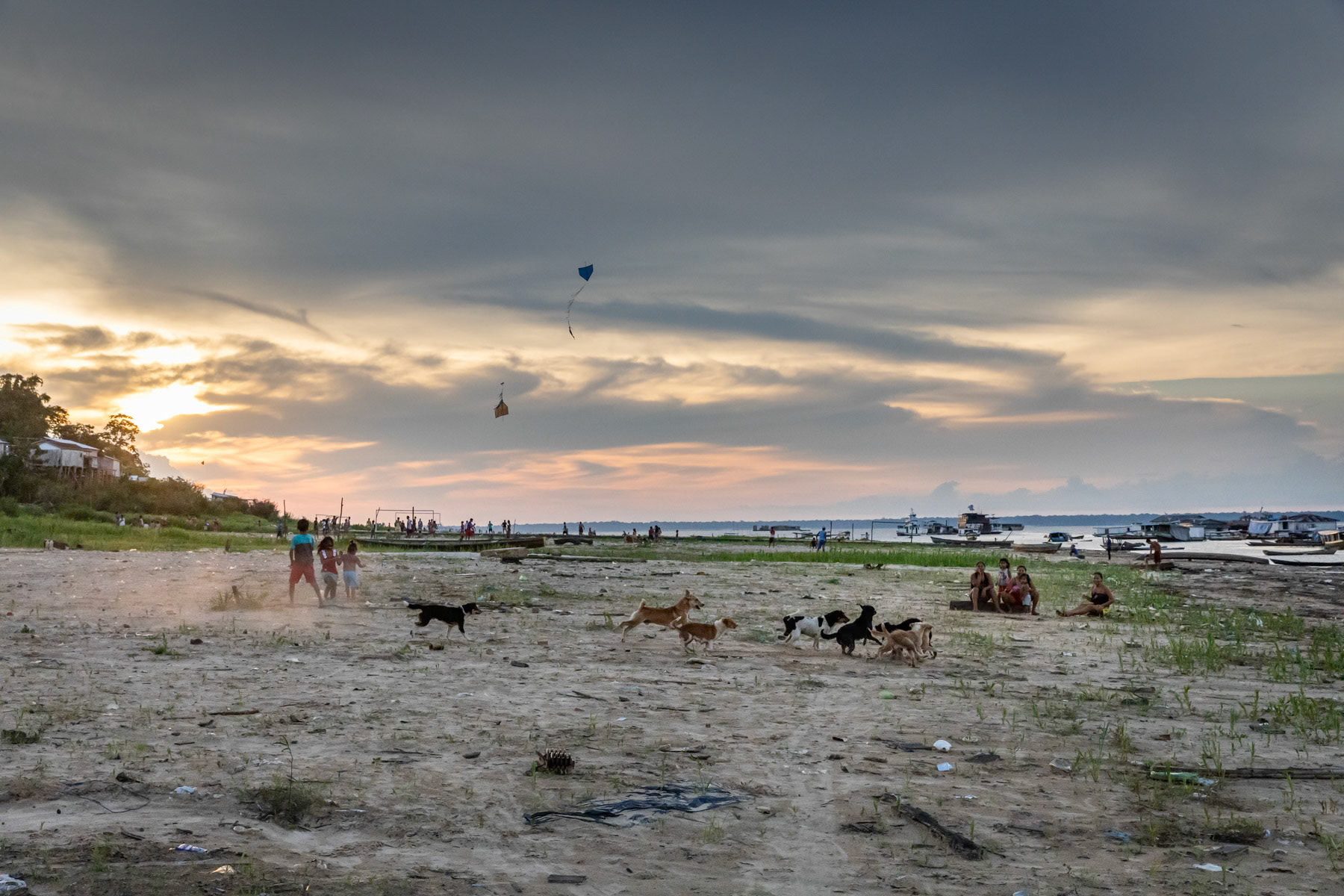
Children playing on the river bank along the Tefé river and its lake. Enormous variations in water level occur between the wet and dry season, hence a combination of floating habitations and houses on pilotis. Tefé, Amazonas state, Brazil, October 2020
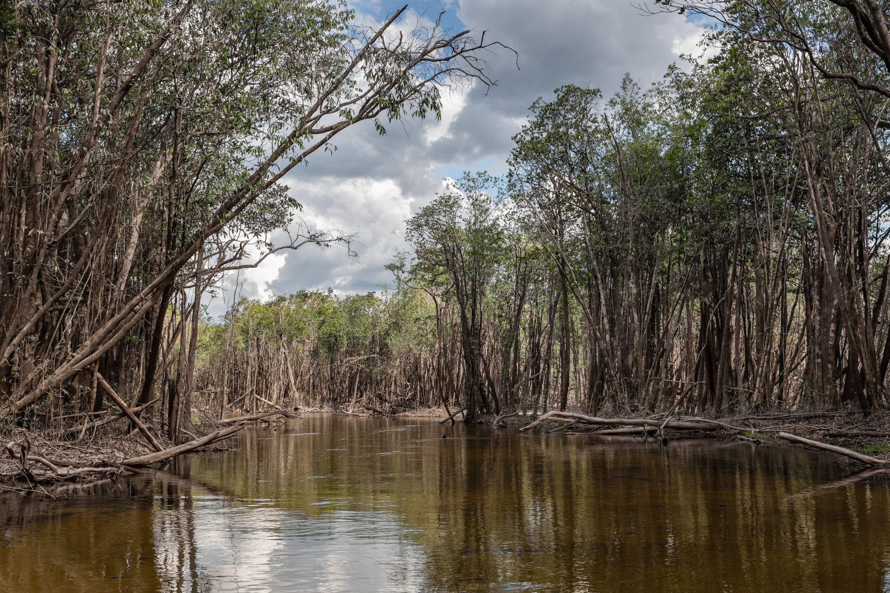
Amazonian rainforest along the Urubu river that is completely flooded from January until July. The combination of the rain season and snow melting in the Andes transforms the Amazonian rivers into lakes and floods the adjacent forests, hence these trees are submerged for nearly 6 months per year. Urubu river basin, Amazonia, Brazil, November 2020
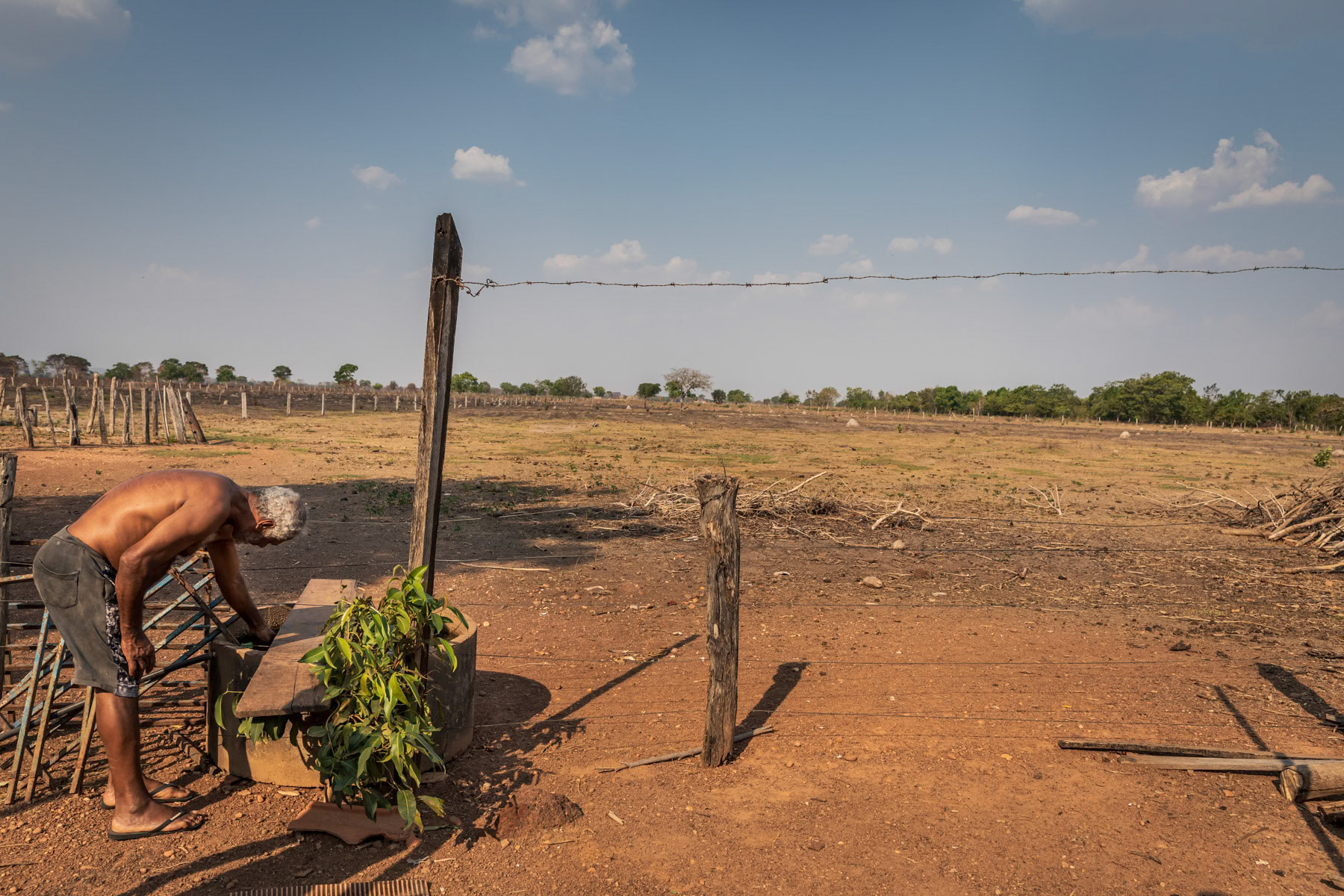
Zico, a cattle farmer, was allocated 20 hectares of land by the government under a social programme to become self-sustainable. He owns in average 20 cows that he can hardly feed during the prolonged periods of accute drought. Barreirão near Nortelândia, Mato Grosso, Brazil, September 2020
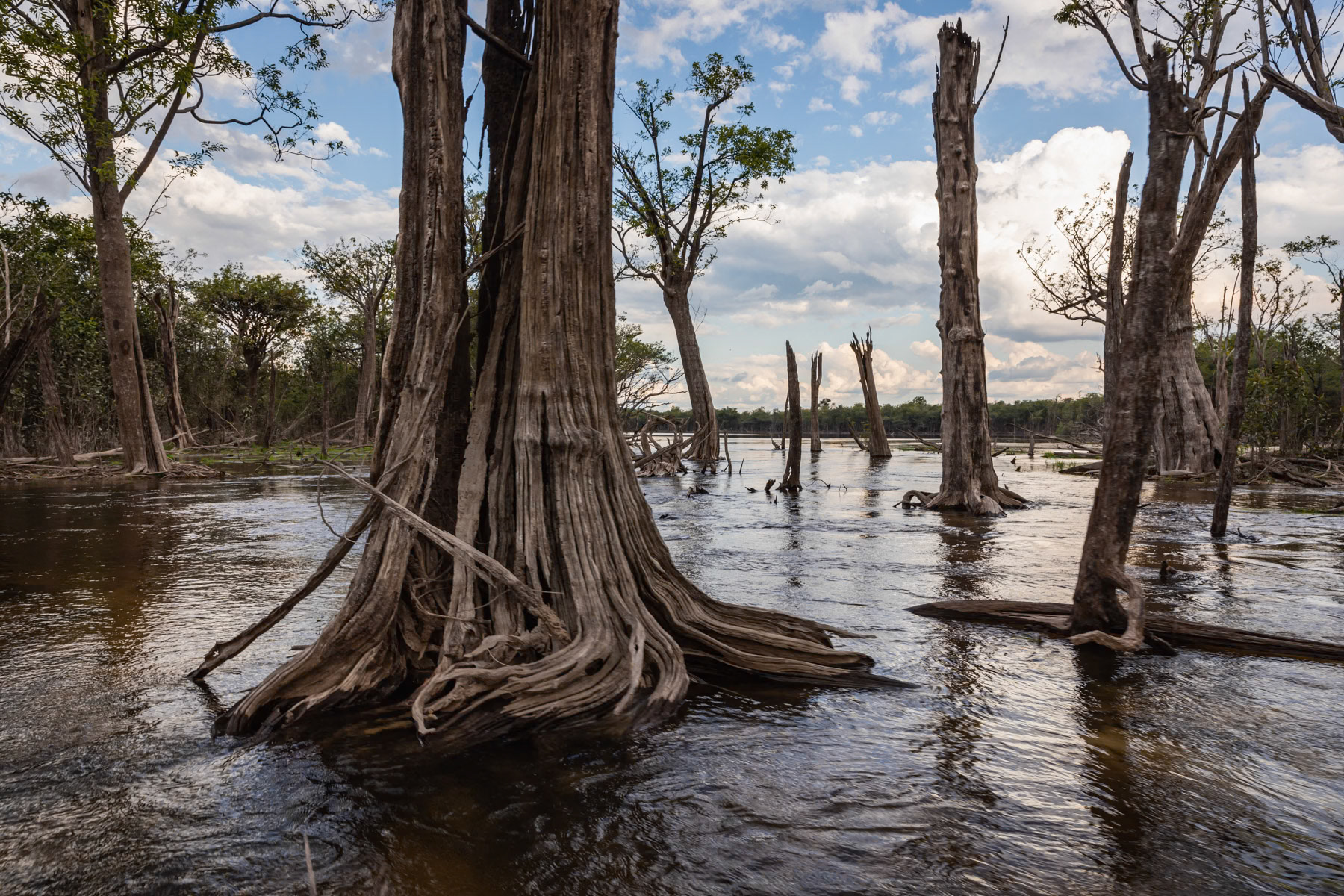
Amazonian rainforest along the Urubu river that is completely flooded from January until July. The combination of the rain season and snow melting in the Andes transforms the Amazonian rivers into lakes and floods the adjacent forests, hence these trees are submerged for nearly 6 months per year. Urubu river basin, Amazonia, Brazil, November 2020
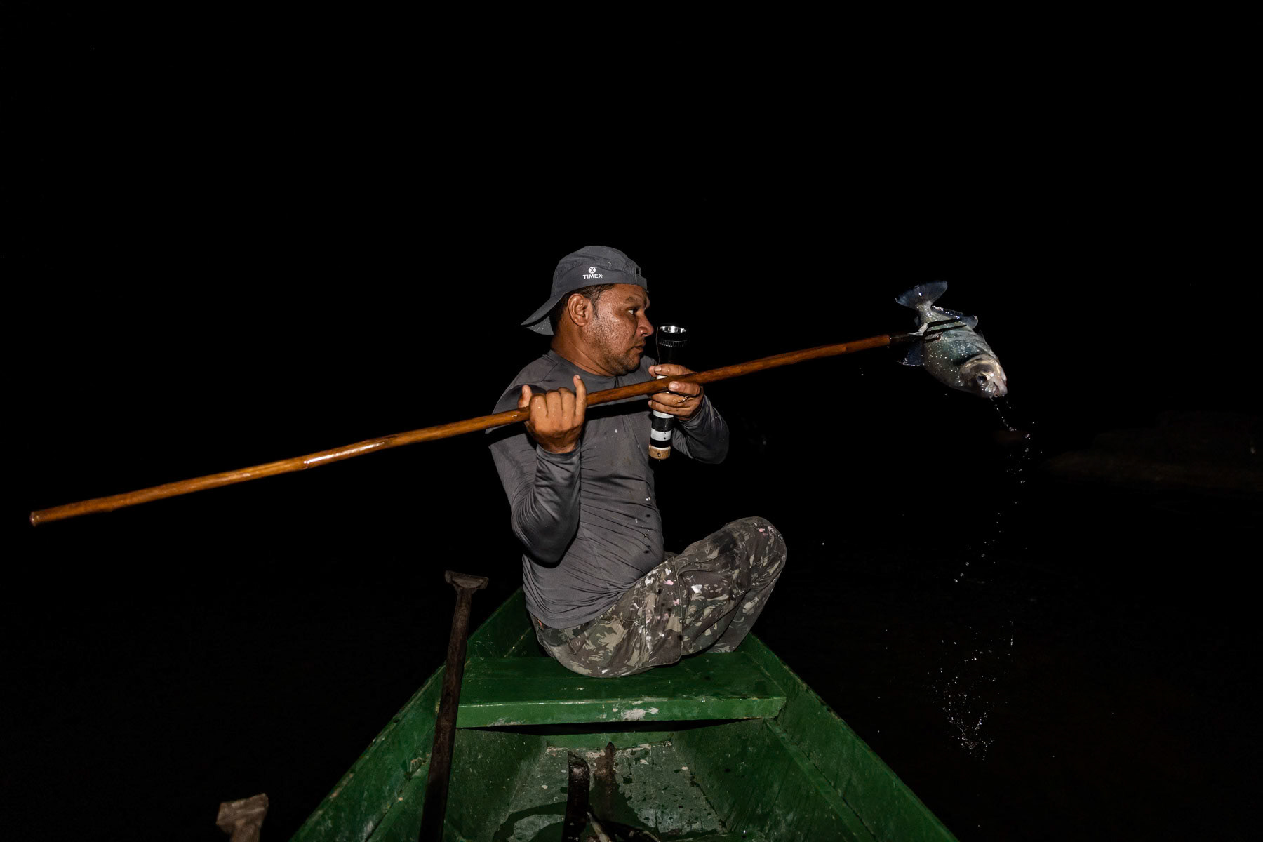
Spear fishing at night for piranha. Urubu river basin, Amazonas state, Brazil, November 2020
